A First-Timer's Week in the Southern Appalachians When Weather Dictates the Plan
Your First Week in the Southern Appalachians When Weather Dictates the Plan
You booked a week of mountain trails and Blue Ridge scenery. Then you woke up to fog so thick you cannot see 20 feet past the windshield, the road closed somewhere near Craggy, and the afternoon forecast calls for thunderstorms rolling in by 2 p.m. Your rigid itinerary just collapsed. The Southern Appalachians do not reward people who commit to a fixed plan. They reward people who check the NPS real time road closure map each morning, who keep three plans ready, and who pivot without resentment.
The solution is not a better forecast app. It is a modular itinerary. Build this week around three menus. A clear day menu for high-altitude objectives. A socked-in menu for low-altitude alternatives. A rainy day menu for indoor fallbacks. You choose from the menu each morning based on the conditions. That is how you get a full week of this terrain instead of two days of hiking and four days of sitting in a cabin watching the rain.
This seven-day, six-night plan runs from mid-April through October. The wet-day probability sits at 60 to 80 percent from April through August and drops to 40 to 60 percent in September and October. You will get rain. The question is whether you let it end your day. This structure ensures it does not.
_(17352273459).jpg)
The Clear Day Menu: High Elevation Objectives
What You’re Hiking
These are the hikes that require visibility and dry rock. They sit at high altitude where the payoff is a 360-degree view or a summit with no tree cover. They are not worth doing in fog or wet conditions. The climb is steep and the reward is the view. If the view is gone, so is the point.
Your clear day menu includes Mount Mitchell from Black Mountain Campground, a 5 to 7 mile round trip with 1,400 to 1,800 feet of gain that takes you to the highest peak east of the Mississippi at 6,684 feet. It includes Craggy Gardens to Craggy Pinnacle at milepost 364, a 5 to 6 mile effort with 1,000 to 1,500 feet of gain that opens onto rhododendron tunnels and ridgeline views. It includes the Graveyard Fields loop at milepost 418.8, a 3.2 mile route with 400 to 600 feet of gain that crosses a high heath bald and two waterfalls. It includes the Alum Cave Trail to Mount LeConte, the premier hike of the Smokies, an 8 to 10 mile round trip day with 1,200 to 1,800 feet of gain that ends at a lodge you can only reach on foot.
On a clear day, commit to one of these before 8 a.m. and accept that you may not finish until late afternoon. Carry rain gear anyway. The forecast can change in the time it takes to drive from Gatlinburg to Newfound Gap.
The Route On Clear Days
Days one through four base from Gatlinburg, Tennessee, or Cherokee, North Carolina, giving you direct access to Great Smoky Mountains National Park. Day one takes the Alum Cave Trail to Alum Cave Bluffs, a 4 to 6 mile introductory day with 600 to 1,200 feet of gain that lets you gauge your fitness before the bigger days. Day two extends that same trail to the LeConte summit, the hardest single day of the week. Day three takes Charlies Bunion via the Appalachian Trail from Newfound Gap, a 6 to 8 mile day with 800 to 1,200 feet of gain. Day four is the rest day with a short paved walk to Clingmans Dome, the highest point in the Smokies at 6,643 feet. Then you transfer 85 to 110 miles to the Asheville area, a drive that takes 2.5 to 3.5 hours on two-lane roads. Days five through seven base near Asheville and hit Graveyard Fields, Mount Mitchell, and Craggy Gardens in sequence, weather permitting.
The Socked in Menu: Low Elevation Alternatives
When The Peaks Disappear
Fog at 5,000 feet does not mean fog at 2,000 feet. When the high peaks are buried, drop lower and shift to valley hikes, waterfall loops, and river walks. These routes stay below the cloud layer, the trail surfaces are more forgiving, and the views are still excellent. They just look different.
Your socked-in menu starts with the Laurel Falls Trail in the Smokies. It is 2.6 miles round trip on a paved surface with gentle grade, making it the wet alternative for day one. For day two, replace the LeConte summit with the Little River Trail at Elkmont, a 5 mile round trip along a stream on a gentle grade. For day three, swap Charlies Bunion for the Deep Creek loop near Bryson City, a 2.4 mile walk past Juney Whank Falls and Tom Branch Falls. For day four, the Mountain Farm Museum and Mingus Mill at the Oconaluftee Visitor Center provide a walk through historic buildings with a covered picnic area and zero gain.
Once You Reach Asheville
After you transfer, the wet alternatives shift to roadside waterfalls and short walks. Looking Glass Falls at milepost 411 offers a view from the car or a short stairway to the base. Linville Falls at milepost 316.4 gives you 1.6 miles of trails with multiple overlooks, no major climbing required. Brevard, the waterfall capital, has a loop connecting Looking Glass, Moore Cove, and Triple Falls that you can complete in a half day without breaking your lungs.
On a socked-in day you can still cover 3 to 6 miles. You just do not go above the cloud ceiling.
The Rainy Day Menu: Indoor Fallbacks
All-Day Deluge
Some days the rain is not a passing shower but an all-day deluge. Thunderstorms build by noon and the lightning risk makes exposed ridges dangerous. On those days you stay dry and go indoors. The region has enough interior options to fill three full days without resentment.
Your rainy day menu includes the Folk Art Center at milepost 382, the flagship gallery of the Southern Highland Craft Guild with rotating exhibits of pottery, woodwork, textiles, and furniture. It includes Wheels Through Time in Maggie Valley, a museum of vintage American motorcycles and automobiles that draws even non-riders into its vast collection. It includes the Biltmore Estate, though budget for it. Entry starts at 75 dollars per person, you must book in advance, and you need at least four hours to see the mansion and the gardens. The conservatory alone can kill a rainy morning.
Small Towns, Zero Weather Dependence
For a less expensive indoor day, work the small towns. Floyd, Virginia, has Friday night bluegrass at the Floyd Country Store with zero pretense and a dance floor that stays active in any weather. Dahlonega, Georgia, has a wine trail with five to eight tasting rooms within 20 minutes of each other. Designate a driver, because the roads between them are curvy and the pours are generous. Hot Springs, North Carolina, offers the historic mineral baths at the Hot Springs Resort and the Appalachian Trail hiker culture at the local diner. None of these require a clear sky.

The Morning Ritual and the Hard Truth About Driving
Your Morning Routine in the Southern Appalachians
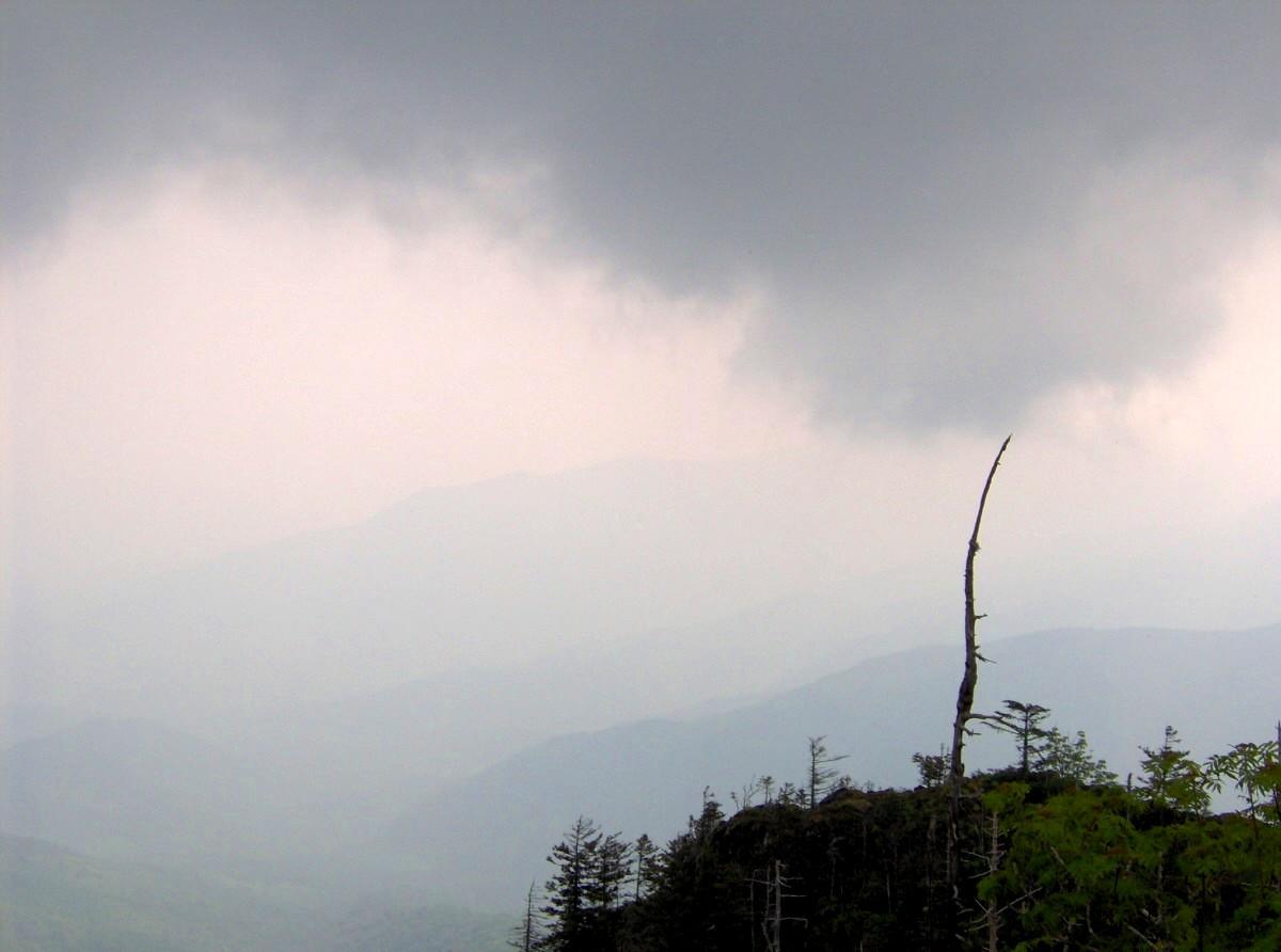
Every morning of this trip starts the same way. Check the NPS real time road closure map before you pack your bag. The Blue Ridge Parkway closes for ice, fog, or rock slides with no advance notice. US 441 through the Smokies does the same. Have a non-Parkway alternate route in your head before you leave the cabin. Download offline Google Maps and AllTrails layers while you are still on Wi-Fi in Asheville or Gatlinburg, because cell service drops to zero the moment you enter a gap or a holler. Verizon and AT&T have the least bad coverage. T-Mobile is nearly useless outside town limits.
Southern Appalachian Drive Times Are Not Estimates
Now the hard truth. The drive times across these mountains are the shortest possible times on dry pavement with no traffic. A 60 mile distance on two-lane mountain roads with 25 mph switchbacks, fog, and pull-offs takes 2 to 2.5 hours. Doing it after dark is genuinely dangerous. Deer, bear, fog, and unlit guardrails combine to create conditions that kill tourists every year. Finish your hiking by 4 p.m. and your driving by sunset. If you cannot reach the trailhead by noon, pick a closer option. Do not drive the Parkway after dark. Do not drive the Cherohala Skyway or the Tail of the Dragon after dark. Do not trust your GPS to route you on paved roads. It will send you onto unpaved Forest Service roads impassable in a sedan. Carry a paper DeLorme Gazetteer and set your navigation to paved roads only.
Common Questions
What is the one thing that kills a first trip itinerary in the Southern Appalachians?
Underestimating drive times. Visitors see a 60 mile distance and budget an hour. On two-lane mountain roads with switchbacks and fog, that drive takes 2 to 2.5 hours. Budget a full morning for any transfer.
How do I know if the Blue Ridge Parkway is open before I leave my lodging?
Check the NPS real time road closure map each morning. The Parkway closes for ice, fog, or rock slides with no notice. Always have a non-Parkway alternate route planned before you drive anywhere.
Can I do this trip without a car?
No. You must rent a car. Rideshare is unreliable beyond Asheville city limits. Gas stations can be 40 or more miles apart. Fill up at half a tank. Download offline maps before leaving Wi-Fi.
What do I do if it rains every day?
Use the rainy day menu. Folk Art Center, Wheels Through Time, Biltmore, small town main streets, Floyd bluegrass, Dahlonega wine tastings, Hot Springs mineral baths. You can fill three days indoors without losing the trip's character.
Read next
-
 Where to Stay in the Southern Appalachians, From Backcountry Shelters to Roadside Motels
A guide to Southern Appalachian lodging: vintage Parkway motor courts, trail-town motels, cabin clusters, and backcountry shelters, with price bands and booking lead times.
Where to Stay in the Southern Appalachians, From Backcountry Shelters to Roadside Motels
A guide to Southern Appalachian lodging: vintage Parkway motor courts, trail-town motels, cabin clusters, and backcountry shelters, with price bands and booking lead times.
-
 Southern Appalachians Trail Towns Where to Base Yourself and When to Camp Instead
Match your Southern Appalachians trip to the right trail town—compare Bryson City, Brevard, Hot Springs, Dahlonega, and more by activity, lodging type, and peak-season availability.
Southern Appalachians Trail Towns Where to Base Yourself and When to Camp Instead
Match your Southern Appalachians trip to the right trail town—compare Bryson City, Brevard, Hot Springs, Dahlonega, and more by activity, lodging type, and peak-season availability.
-
 Flying Into the Southern Appalachians, Airport by Airport
Compare AVL, TYS, and CLT airports for the Southern Appalachians: drive times, rental-car costs, and why a personal vehicle is non-negotiable.
Flying Into the Southern Appalachians, Airport by Airport
Compare AVL, TYS, and CLT airports for the Southern Appalachians: drive times, rental-car costs, and why a personal vehicle is non-negotiable.
-
 Best Time to Visit the Southern Appalachians for Trails and Quiet
Season-by-season timing for the Southern Appalachians, including mud-season trail closures, October leaf-peeper gridlock, and June rhododendron blooms.
Best Time to Visit the Southern Appalachians for Trails and Quiet
Season-by-season timing for the Southern Appalachians, including mud-season trail closures, October leaf-peeper gridlock, and June rhododendron blooms.
-
 Getting Around the Southern Appalachians Without a Transit System
How to get around the Southern Appalachians when there is no transit, cell service drops, and GPS routes you onto impassable roads.
Getting Around the Southern Appalachians Without a Transit System
How to get around the Southern Appalachians when there is no transit, cell service drops, and GPS routes you onto impassable roads.
-
 Southern Appalachian Food, From Trail Resupply to Meat-and-Three Plates
Practical food guide for the Southern Appalachians: where to eat after a hike, where to resupply, and what to expect when restaurants close by 8:30 p.m.
Southern Appalachian Food, From Trail Resupply to Meat-and-Three Plates
Practical food guide for the Southern Appalachians: where to eat after a hike, where to resupply, and what to expect when restaurants close by 8:30 p.m.
-
 Blue Ridge and Pisgah
The Asheville and Pisgah side of the Southern Appalachians along the Blue Ridge Parkway, with waterfall loops, craft breweries, and Mount Mitchell.
Blue Ridge and Pisgah
The Asheville and Pisgah side of the Southern Appalachians along the Blue Ridge Parkway, with waterfall loops, craft breweries, and Mount Mitchell.
-
 Great Smoky Mountains
A Great Smoky Mountains guide focused on quiet gateways like Bryson City and Townsend, dawn wildlife viewing at Cades Cove, and avoiding Gatlinburg crowds.
Great Smoky Mountains
A Great Smoky Mountains guide focused on quiet gateways like Bryson City and Townsend, dawn wildlife viewing at Cades Cove, and avoiding Gatlinburg crowds.
-
 North Georgia
's quiet end of the Southern Appalachians, from Springer Mountain's AT start to Dahlonega's wine trail and Tallulah Gorge's permitted floor.
North Georgia
North Georgia's quiet end of the Southern Appalachians, from Springer Mountain's AT start to Dahlonega's wine trail and Tallulah Gorge's permitted floor.