Hiking the Chimney Tops Trail After the Fire and the Permanent Closure
The Chimney Tops Trail no longer reaches the rock pinnacles—the final scramble is closed permanently after the 2016 wildfire, and the trail ends at a lower observation deck.

The Hard Truth About the Chimney Tops Pinnacles
You cannot reach the top of Chimney Tops. The final scramble to the rock pinnacles has been permanently closed since the Chimney Tops 2 Fire burned 17,000 acres in November 2016. The trail now ends at a wooden viewing platform at 4,700 feet, 100 feet lower than the pinnacles. The old summit is gone for good. The question is whether the hike is still worth your time. The answer is yes, but only if you adjust what you expect.
The fire was arson. It destroyed 2,400 structures in the Gatlinburg area and killed 14 people. The ecological damage to the mountainside was severe enough that the National Park Service made a permanent call: no more foot traffic on the final rock spine. The trail reopened October 6, 2017, with a reconstructed surface of crushed stone, rock steps, and elevated boardwalk sections. The surface before the fire was natural earth and exposed rock. The new surface is engineered for erosion control and long-term stability. It is not the same trail. Do not go looking for the old one.
- Round Trip Distance: 3.6 miles (closed at viewing platform)
- Elevation Gain: 1,200 feet
- Elevation at Viewing Platform: 4,700 feet
- Average Grade: 12%
- Trailhead Location: Newfound Gap Road, 6.7 mi south of Sugarlands Visitor Center
- Current Terminus: Viewing platform with rock seating, 360-degree panorama
- Difficulty Rating: Strenuous
- Pinnacle Scramble Status: Permanently closed since 2016
- Annual Visitation: Over 200,000 (pre-fire)
What You Actually Get at the New Endpoint
The viewing platform at 4,700 feet is not a consolation prize. It delivers a 360-degree panorama that includes Mount Le Conte, Sugarland Mountain, and Anakeesta Ridge. The rock seating lets you stay for ten minutes or an hour. The view is open, broad, and unobstructed. You will not feel cheated standing there.
The hike to get there is still a quad-burning climb. You gain 1,200 feet in 1.8 miles. The average grade is 12 percent, which means sustained steepness with no flat sections to catch your breath. The trail surface changes constantly: crushed stone gives way to rock steps, then to boardwalk bridges over the worst of the eroded gullies. The fire scar is visible the whole way. You walk through a landscape that is still healing. Charred trunks stand beside new growth. The understory is thick with ferns and saplings. This is not a postcard wilderness. It is a real-time recovery zone.
The Ecological Damage That Made the Closure Necessary
The Chimney Tops 2 Fire burned so hot on the pinnacle that it sterilized the soil. The old footpath up the rock spine became unstable. Loose boulders, exposed roots, and deep ash layers made the scramble hazardous. The Park Service faced a choice: rebuild a handline route that would require annual maintenance and still risk injury, or close that section permanently. They chose closure. The decision was unpopular with repeat visitors who remembered the summit. But the alternative was a trail that would have needed constant rock work and still could have killed someone. The viewing platform solution gives you the same view from a stable platform.
How the Trail Changed After the Fire
The old trail was a dirt path with exposed rock sections. It eroded badly every rainy season. The rebuilt trail uses crushed stone and rock steps to handle the 200,000-plus annual visitors who still show up. The boardwalk sections protect the most fragile sections of the recovering slope. The trail is wider in places to reduce the bottleneck effect that made the old route dangerous. You will pass more people than you expect. This is one of the most popular hikes in the Smokies. The short distance to a summit view pulls in everyone from Gatlinburg. Arrive by 07:30 on summer weekends. The trailhead parking lot on Newfound Gap Road fills by 08:30. The walk itself takes two to three hours round trip depending on your pace and how long you stop at the deck.
A Cautionary Tale About Fire Scarred Landscapes
The Chimney Tops Trail is not a scenic overlook. It is a lesson in what wildfire does to a mountain. The fire that closed the pinnacle started on November 23, 2016, and burned for 18 days. It jumped from the ridge into Gatlinburg with terrifying speed. Fourteen people died. The town rebuilt, but the mountain did not. The trail you walk today shows you exactly what recovery looks like up close. You see the skeletons of ancient red oaks. You see the rhododendron that resprouted from the roots. You see the rock faces that were sandblasted bare by the heat. The view from the deck includes the blackened snags on nearby ridges. This is not a sanitized version of nature.
That is the value of this hike. It strips away the idea that the Smokies are a permanent postcard. The mountains change. Fire is part of that change. The permanent closure of the pinnacle is not a bureaucratic overreach. It is the honest response to a landscape that cannot support the same use it once did. If you want the old Chimney Tops, you missed it. If you want to understand what fire does and what recovery looks like, this trail delivers.
_(Chimney_Tops_Trail,_Great_Smoky_Mountains,_Tennessee,_USA)_(37047450251).jpg)

Who This Trail Suits and Who Should Skip it
This trail is for hikers who want a strenuous climb in a short distance. It suits leaf-peepers willing to earn their views. It suits people who want to see the fire recovery zone without requiring a backcountry permit. The 1,200-foot elevation gain is real. If you have knee problems, ankle instability, or any mobility limitation that makes steep uneven terrain difficult, skip this hike. The viewing platform is lower than the old pinnacle but the trail to get there is the same steep grade. There is no gentle option. The scenic overlooks in Cades Cove or on the Blue Ridge Parkway require less effort.
The trail also does not suit anyone who wants solitude. This is a very heavy traffic route. You will share the crushed stone with families, day hikers, and groups of ten. The trailhead parking lot is a bottleneck that can add 30 minutes of circling to your day. If you want quiet, take the Alum Cave Trail to Mount Le Conte instead. That hike is longer but the crowds thin out after the first mile. The Chimney Tops Trail stays busy to the deck.
For the hiker who can handle the grade and the crowd, the payoff is a summit view that the fire could not erase. The 360-degree panorama from 4,700 feet shows you exactly why the Smokies draw 12 million visitors a year. You see ridge after ridge fading into blue haze. You see the scarred hillsides that will be green again in a decade. The trail is shorter than it used to be. But it still earns its place on your itinerary.
Common Questions
Why is the Chimney Tops pinnacle permanently closed?
The 2016 Chimney Tops 2 Fire burned 17,000 acres and sterilized the soil on the final rock spine. The scramble became unstable and dangerous. The National Park Service closed it permanently in 2016 rather than rebuild a route that would require constant maintenance and still risk injury.
How long is the Chimney Tops Trail now?
The trail is 3.6 miles round trip, ending at a viewing platform at 4,700 feet. The pre-fire trail was 4.0 miles round trip to the pinnacle at 4,800 feet. The difference is 0.4 miles and 100 vertical feet.
Can you still see the summit views?
Yes. The viewing platform at 4,700 feet offers a 360-degree panorama of Mount Le Conte, Sugarland Mountain, and Anakeesta Ridge. The view is unobstructed and includes the fire scar and surrounding ridges.
Should I still hike the Chimney Tops Trail?
Yes, if you want a strenuous short hike with a summit view and you understand the trail ends at a deck, not the pinnacle. No, if you want solitude, gentle terrain, or the old scramble. Go before 07:30 to avoid parking delays.
Read next
-
 Alum Cave Trail to Mount LeConte
The Alum Cave trailhead lot fills before sunrise most of the year—here is where to park legally, when the shuttle runs, and what the climb to Mount LeConte actually demands.
Alum Cave Trail to Mount LeConte
The Alum Cave trailhead lot fills before sunrise most of the year—here is where to park legally, when the shuttle runs, and what the climb to Mount LeConte actually demands.
-
 Charlies Bunion
 delivers the best single-day Appalachian Trail experience in the Smokies—an 8-mile round-trip from Newfound Gap with ridgeline exposure and a rocky outcrop finish.
Charlies Bunion
Charlies Bunion delivers the best single-day Appalachian Trail experience in the Smokies—an 8-mile round-trip from Newfound Gap with ridgeline exposure and a rocky outcrop finish.
-
 Where to Stay in the Southern Appalachians, From Backcountry Shelters to Roadside Motels
A guide to Southern Appalachian lodging: vintage Parkway motor courts, trail-town motels, cabin clusters, and backcountry shelters, with price bands and booking lead times.
Where to Stay in the Southern Appalachians, From Backcountry Shelters to Roadside Motels
A guide to Southern Appalachian lodging: vintage Parkway motor courts, trail-town motels, cabin clusters, and backcountry shelters, with price bands and booking lead times.
-
 Southern Appalachians Trail Towns Where to Base Yourself and When to Camp Instead
Match your Southern Appalachians trip to the right trail town—compare Bryson City, Brevard, Hot Springs, Dahlonega, and more by activity, lodging type, and peak-season availability.
Southern Appalachians Trail Towns Where to Base Yourself and When to Camp Instead
Match your Southern Appalachians trip to the right trail town—compare Bryson City, Brevard, Hot Springs, Dahlonega, and more by activity, lodging type, and peak-season availability.
-
 Flying Into the Southern Appalachians, Airport by Airport
Compare AVL, TYS, and CLT airports for the Southern Appalachians: drive times, rental-car costs, and why a personal vehicle is non-negotiable.
Flying Into the Southern Appalachians, Airport by Airport
Compare AVL, TYS, and CLT airports for the Southern Appalachians: drive times, rental-car costs, and why a personal vehicle is non-negotiable.
-
 Best Time to Visit the Southern Appalachians for Trails and Quiet
Season-by-season timing for the Southern Appalachians, including mud-season trail closures, October leaf-peeper gridlock, and June rhododendron blooms.
Best Time to Visit the Southern Appalachians for Trails and Quiet
Season-by-season timing for the Southern Appalachians, including mud-season trail closures, October leaf-peeper gridlock, and June rhododendron blooms.
-
 Getting Around the Southern Appalachians Without a Transit System
How to get around the Southern Appalachians when there is no transit, cell service drops, and GPS routes you onto impassable roads.
Getting Around the Southern Appalachians Without a Transit System
How to get around the Southern Appalachians when there is no transit, cell service drops, and GPS routes you onto impassable roads.
-
 Your First Week in the Southern Appalachians Built Around Weather Not a List
-
 Blue Ridge and Pisgah
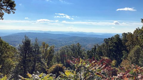
The Asheville and Pisgah side of the Southern Appalachians along the Blue Ridge Parkway, with waterfall loops, craft breweries, and Mount Mitchell.
Blue Ridge and Pisgah
The Asheville and Pisgah side of the Southern Appalachians along the Blue Ridge Parkway, with waterfall loops, craft breweries, and Mount Mitchell.