Southern Appalachian Waterfalls Where the View Justifies the Risk
The Southern Appalachian waterfall hikes that have killed people, the specific hazards on each trail, and safer nearby alternatives.
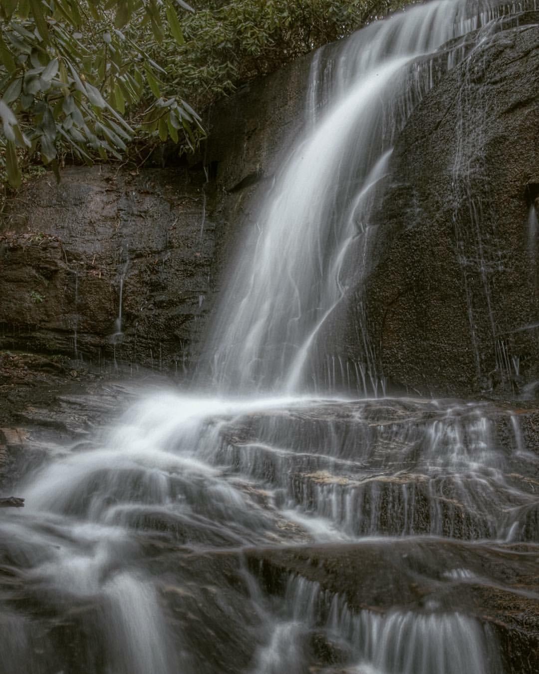

Southern Appalachian Waterfalls That Have Killed People
The mist hits your face a quarter mile before you see Rainbow Falls. By the time you reach the gorge the roar is a physical pressure in your chest. That is the moment when the slip happens. The polished Thunderhead Sandstone under your feet, wet from the plume, has a friction coefficient somewhere between ice and wet tile. Every year someone finds out the hard way. Do not mistake beauty for safety. These are the waterfalls in the Southern Appalachians that have killed people, exactly how each death happened, and where to go instead.
Rainbow Falls in the Smokies: the Deadliest Waterfall on the Trail System
Rainbow Falls in Great Smoky Mountains National Park is an 80 foot drop on a 5.4 mile round trip hike with 1,500 feet of elevation gain. Four people have died in falls from the brink since 2000. The mechanism is always the same. Visitors step onto the algae slicked sandstone at the edge to get a photo, their shoes lose grip on the biofilm layer that reduces friction by up to 50 percent compared to dry rock, and they go over. The surface coefficient on wet Thunderhead Sandstone is 0.2 to 0.4. Dry rock runs 0.6 to 0.8. You do not fall and grab a branch. You fall 80 feet onto boulders.
Rainbow Falls accounts for the highest incident count of any waterfall in the park. Between 2013 and 2023, GSMNP recorded 12 confirmed waterfall related fatalities total, and falls from height are among the top three causes of visitor death. Search and rescue costs run $5,000 to $15,000 per operation. You pay nothing for the rescue if you survive. The park charges nothing because it cannot. The real cost is the one you do not get to calculate.
Where to Go Instead: Grotto Falls
Grotto Falls is 2.6 miles round trip from the same Roaring Fork Motor Nature Trail, with 500 feet of elevation gain. The waterfall is only 25 feet high, but you walk behind the cascade, which delivers the immersive sensation without the lethal geometry. The trail is steep in sections but the rock at the falls is rougher and the pool is shallow. You get the thunder. You get the cool. You stay on your feet.
Turtleback Falls: the Hydraulic That Does Not Let Go
Turtleback Falls, also called Umbstead Falls in some older maps, sits on the Horsepasture River in the Gorges State Park area near Brevard. People wade into the plunge pool at the base and the hydraulic current pins them underwater. The mechanism is a recirculating wave at the bottom of the drop. It looks like a swimming hole. It behaves like a washing machine. Three recorded fatalities since 2010 across the Dupont State Forest and Horsepasture corridor are tied to this kind of wading behavior. Do not assume that a crowded swimming spot is a safe one.
The Horsepasture River is not a controlled release river like the Nantahala. Flow fluctuates with rain, and a clear morning can turn into a flashy afternoon. When the water is up, the hydraulic at the base of Turtleback becomes stronger and the ledge at the top is coated in the same biofilm that plagues Rainbow Falls. The combination of a slide and a pool means people get a false sense of a complete experience: you slide in, you swim, you are done. But the exit at Turtleback is not a calm eddy. It is a recirculating trap.
Where to Go Instead: Sliding Rock on the Blue Ridge Parkway
Sliding Rock is a natural 60 foot waterslide on the Parkway that the Forest Service operates as a paid attraction. Entry costs $5 per person. The water is 50 to 60 degrees and takes your breath away. The difference is that Sliding Rock has a controlled landing pool with a consistent depth and rangers on site during operating hours. Lifeguards are not present, but the hazard profile is predictable. Do not confuse tame with safe. Slide on your back, feet first, arms crossed. Do not stand up in the pool. Do not go at night. Follow the rules and you get the thrill without the body count.
Looking Glass Falls and the Dupont State Forest Fatalities
Looking Glass Falls in Pisgah National Forest is a roadside 60 foot drop that draws hundreds of people an hour on summer weekends. Fatalities here come from climbing on the wet granite at the base and from wading too close to the churning water at the foot of the falls. The rock face at Looking Glass is a pluton, a massive dome of granite that erodes into smooth curves, and people treat it like a waterslide. It is not a waterslide. Three fatalities have been recorded in the Dupont State Forest system since 2010, and while Looking Glass is not inside Dupont, it shares the same geological character.
Dupont State Forest contains six major named waterfalls: High Falls at 120 feet, Triple Falls at 120 feet over three cascades, Hooker Falls at 12 to 14 feet, Bridal Veil Falls at 120 feet of sliding rock face, plus Wintergreen and Grassy Creek Falls. The trail system runs 86 miles. High Falls and Triple Falls are the two that draw climbers and waders. The issue at High Falls is the same as Rainbow Falls: people step to the edge of the 120 foot drop for a photograph, the algae coated granite betrays them, and they fall. Hooker Falls is low enough that wading seems safe, but the current at the base can knock an adult off their feet and pin them against submerged logs. Three fatalities in a decade across a county with over 250 mapped waterfalls means the risk is not abstract. It is statistical.
Where to Go Instead: Moore Cove Falls
Moore Cove Falls is a 1.2 mile round trip hike from the same parking area as Looking Glass, with negligible elevation gain. The waterfall is 50 feet and you can walk behind it. The pool at the base is shallow and the rock is less polished because the falls are seasonal and the flow is gentler. Go in late spring or after a rain. The walk is through old growth hemlock, the sound is cathedral quiet, and you do not end your day in a hospital.
Deep Creek and the Hydraulic at Indian Creek Falls
Deep Creek in the Smokies near Bryson City is a popular tubing and hiking area with a 2.4 mile loop that passes three waterfalls: Juney Whank at 90 feet, Tom Branch at 60 feet, and Indian Creek at 25 feet. The loop gains 300 feet from the 1,800 foot trailhead. One fatality has been recorded since 2000. The victim waded into the base of Indian Creek Falls after a rain event when the flow was high and the hydraulic current held them under. Indian Creek Falls is only 25 feet, which is precisely the problem. A low drop creates a deep plunge pool that looks benign. The water recirculates at the bottom and a person caught in the boil cannot swim clear because the current pushes them back under the falling water. Twenty five feet is tall enough to drown in.
The park closes waterfalls when flow exceeds 2,000 cubic feet per second, but that protocol applies to the major named falls on the auto tours, not to every cascade on the Deep Creek trail. You have to judge the flow yourself. If the base of Indian Creek is churning white, stay out. If the pool looks like a washing machine, it is. Tubing on Deep Creek is a separate activity and is safe if you wear a life jacket, but do not confuse tubing with wading. Tube through the flat sections. Walk the falls loop. Do not swim at the base.
Where to Go Instead: Juney Whank Falls
Juney Whank Falls is the tallest of the three at 90 feet, and it plunges into a rocky bowl that is not swimmable, which is exactly the point. The trail up to the overlook is less steep than the main loop and the viewing platform keeps you off the slick rock. You get the full height, the mist, the roar, and zero temptation to step to the edge. Bring a rain jacket. The spray carries.
.jpg)
Amicalola Falls: the Staircase That Claims a Life Every Few Years
Amicalola Falls in Georgia is the tallest cascading waterfall in the state at 729 feet. The state park opened in 1940. Two fatalities have occurred since 2000. Both involved visitors climbing over the railings on the staircase route, which consists of 604 steps to the top. The stairs are steep, wet, and crowded. People lean over to photograph the drop, lose their balance, and fall from height. The staircase is not a trail. It is a vertical climb on metal grates. If you are afraid of heights or unsteady on your feet, do not take the stairs. The base to top trail is 2.1 miles round trip with 600 feet of elevation gain and runs through forest, not up the face. Take that trail.
The park has signs. The railings are standard height. None of that stops someone from leaning over to frame a shot. The 729 foot height means a fall is not survivable. The park draws heavy visitation and the fatality rate is low, but it is not zero. The staircase is the one place in the park where you are exposed to the full drop without a barrier between you and the void. Treat it like a climb, not a walk.
Where to Go Instead: The Base Viewing Platform
The base of Amicalola Falls has a large viewing platform that puts you at the foot of the cascade without the staircase exposure. You get the full height looking up. The spray cools the platform by 10 degrees on a July afternoon. Arrive by 09:00 before the school groups arrive. The reflection pool at the bottom mirrors the entire falls on calm mornings. You will not need the stairs for the best photograph. You need the platform and a wide angle lens.
The Honest Caveat
Every safer alternative listed here still has risk. Grotto Falls has a slick section behind the cascade. Sliding Rock has broken bones from people sliding headfirst. Moore Cove Falls has a muddy approach after rain. Juney Whank Falls has a steep wooden staircase that gets slick in wet weather. The safer option is not the safe option. It is the option where your odds improve from lethal to merely dangerous. The only truly safe choice is to stay on the trail, behind the barrier, and accept that you will see the waterfall from a distance. That is not a compromise that kills the experience. It is the decision that lets you go home.
Common Questions
Which waterfall in the Southern Appalachians has the most recorded deaths?
Rainbow Falls in Great Smoky Mountains National Park has four recorded fatal falls since 2000, the highest count of any waterfall in the region. The deaths occurred when visitors slipped on algae slicked Thunderhead Sandstone at the brink of the 80 foot drop.
Is it safe to swim at the base of any waterfall in the Smokies?
No. Do not swim or wade at any waterfall base in the Smokies. Hydraulic currents, submerged logs, and cold water shock cause drownings even at low falls like Indian Creek at 25 feet. Stay on marked trails and behind railings.
What makes waterfall rocks so slippery in the Southern Appalachians?
A biofilm of algae and moss grows on the wet rock surface, reducing friction by up to 50 percent compared to dry granite. The friction coefficient on wet sandstone can drop to 0.2, equivalent to walking on ice. Shoes rated for wet rock help but do not eliminate the risk.
What should I do if I see someone fall from a waterfall?
Call emergency services immediately. Note the exact location using a GPS coordinate or trail marker. Do not attempt a rescue from the water. The hydraulic current that pulled the victim under will also pull you under. Wait for trained search and rescue personnel.
Read next
-
 Southern Appalachians Winter Hiking What Stays Open and What Ices Over
Which Southern Appalachian trails stay open in winter, which roads ice over and close without warning, and how to hike safely when the Parkway shuts down.
Southern Appalachians Winter Hiking What Stays Open and What Ices Over
Which Southern Appalachian trails stay open in winter, which roads ice over and close without warning, and how to hike safely when the Parkway shuts down.
-
 Smokies vs Blue Ridge Which Half of the Southern Appalachians Fits Your Week
Smokies or Blue Ridge for a one-week Southern Appalachians trip—how the two halves compare in crowds, terrain, towns, and daily logistics.
Smokies vs Blue Ridge Which Half of the Southern Appalachians Fits Your Week
Smokies or Blue Ridge for a one-week Southern Appalachians trip—how the two halves compare in crowds, terrain, towns, and daily logistics.
-
 Southern Appalachian Permits and Reservations You Need to Book Ahead
Every Southern Appalachian permit and reservation you need to book ahead: Grandfather Mountain, Biltmore, Tallulah Gorge floor access, and backcountry quotas.
Southern Appalachian Permits and Reservations You Need to Book Ahead
Every Southern Appalachian permit and reservation you need to book ahead: Grandfather Mountain, Biltmore, Tallulah Gorge floor access, and backcountry quotas.
-
 What to Pack for the Southern Appalachians, Where Wet and Steep Rewrite the Rules
Packing list for the Southern Appalachians, where 1,000-foot climbs come on short trails and weather flips from sun to sideways rain in 20 minutes.
What to Pack for the Southern Appalachians, Where Wet and Steep Rewrite the Rules
Packing list for the Southern Appalachians, where 1,000-foot climbs come on short trails and weather flips from sun to sideways rain in 20 minutes.