Four Low Commitment Overnight Hikes Across Georgia and North Carolina
A practical guide to Four Low Commitment Overnight Hikes Across Georgia and North Carolina.

What makes an overnight hike low commitment
An overnight hike does not need to mean heavy packs, rigid itineraries, or permits booked months in advance. Across Georgia and North Carolina, several trail systems reward walkers who want a single night under the trees without the logistical weight of a multi-day expedition. The four routes described here share a few practical traits. Each can be reached from a public trailhead with free parking. None requires a reservation or a fee for backcountry camping. Distances stay modest enough that a late start still leaves time to set up camp before dark, and the terrain offers natural turnaround points for hikers who prefer a shorter day.
What varies is the character of the night you will spend. One route leads to an Appalachian Trail shelter with a privy and a nearby water source. Another crosses a designated wilderness where you choose your own site, provided you follow the distance rules that protect streams and wildlife openings. A third sits above 6,000 feet and demands a bear canister by regulation. The fourth follows a historic trace past the remains of a Vanderbilt retreat, with water never far away thanks to more than a dozen stream crossings. Choosing among them is less about fitness and more about the kind of evening you want once the walking stops.
Three Forks to Hawk Mountain Shelter on the Appalachian Trail
Three Forks is a valley in the Chattahoochee National Forest near Ellijay, Georgia, where three streams converge to form Noontootla Creek. The spot sits at the junction of the Appalachian Trail and the Benton MacKaye Trail, making it a natural starting point for an overnight that follows white blazes north. The trailhead is reached by gravel Forest Service Road 58, and parking is free.
A short walk from the trailhead leads to Long Creek Falls, roughly two miles round trip. For an overnight, continue past the falls toward Hawk Mountain Shelter. The full out-and-back from Three Forks to the shelter covers about 9.1 miles round trip. Hawk Mountain Shelter sits at an elevation of 3,145 feet and offers a privy and a water source down a path behind the structure. Limited tent camping exists outside the shelter itself. Every campsite at Three Forks and along this section of the Appalachian Trail is primitive, free, and first-come, first-served. No reservation system exists, so a backup plan is wise during busy weekends. Before heading out, check current conditions with the Chattahoochee-Oconee National Forests.
Birkhead Mountains Wilderness in the Uwharrie National Forest
The Birkhead Mountains Wilderness protects 5,160 acres at the northern end of the Uwharrie Mountains in North Carolina. Established by the 1984 North Carolina Wilderness Act, the area is laced with hiking-only trails where travel by horse, motorized vehicle, or bicycle is prohibited. That restriction shapes a quiet experience, and the trail network is compact enough to build a loop that fits a single overnight without shuttling a car.
Four named trails form the backbone of the system. The Thornburg Trail runs 1.8 miles, Robbins Branch Trail covers 3.0 miles, Hannahs Creek Trail stretches 1.4 miles, and the Birkhead Mountain Trail extends 5.9 miles. Trailhead parking is available at Tot Hill, Thornburg, and Robbins Branch. Dispersed camping is allowed throughout the wilderness, with one firm rule: camp at least 200 feet from all streams, creeks, roads, and wildlife fields. No reservations are needed and no fees are charged. Because the Uwharries sit at a lower elevation than the mountain routes further west, this area often dries out earlier in spring and stays accessible later into fall.
Sam Knob Loop in the Shining Rock Wilderness
The Shining Rock Wilderness, designated in September 1964, encompasses more than 18,000 acres of Pisgah National Forest with elevations ranging from 3,300 to over 6,000 feet. The Sam Knob Loop begins from the Black Balsam trailhead off the Blue Ridge Parkway and climbs to the summit of Sam Knob at 6,045 feet. The high, open terrain delivers long views, but it also exposes campers to regulations that do not apply on the lower-elevation routes.
Bear-resistant canisters are mandatory for all overnight campers in the Sam Knob and Flat Laurel Creek vicinity under a standing Forest Order issued by the Pisgah Ranger District. Campfires are not allowed anywhere in the Shining Rock Wilderness, and groups may not exceed ten people at any time. These rules are enforced, not advisory. Before planning a trip, verify that the bear canister requirement remains in effect by checking the National Forests in North Carolina alerts page. The tradeoff for the extra preparation is a high-country overnight with a true wilderness character, where the lack of firelight and the requirement to store food properly keep the focus on the ridgeline and the sky.
Buck Spring Trail along the Blue Ridge Parkway
The Buck Spring Trail, designated Trail No. TR104, begins behind the Pisgah Inn at Blue Ridge Parkway milepost 408.6 and descends roughly 1,100 feet over 6.2 miles to US 276. The trail is part of the Mountains-to-Sea Trail and is open year-round for foot traffic only. Because it is a point-to-point route, an overnight here requires either a shuttle vehicle or a willingness to retrace your steps for a longer out-and-back.
Water is a defining feature of this trail. Thirteen stream crossings mean you will rarely walk far without access to a water source, though treatment is still necessary. The route passes the historic site of Buck Spring Lodge, built in 1896 as a mountain retreat for George Vanderbilt. The lodge no longer stands, but old stonework and stairs remain, offering a place to pause and consider the layers of use on this land. The Pisgah Inn and the Blue Ridge Parkway are subject to seasonal closures, so verify road and facility status with the National Park Service before committing to a trip. When the parkway is open, starting at the inn allows you to park near amenities and walk downhill into a forested corridor that feels far removed from the ridgeline crowds.
How to choose among these four routes
If your priority is simplicity, the Three Forks to Hawk Mountain Shelter route offers the most structured overnight. A designated shelter, a privy, and a known water source reduce the variables you need to manage. The cost is popularity: first-come, first-served camping means you may arrive to find the shelter full on a weekend.
For solitude, the Birkhead Mountains Wilderness is the strongest candidate. The hiking-only trail rule eliminates bikes and horses, and the dispersed camping policy lets you spread out. The lower elevation means less dramatic views, but also fewer people and a longer comfortable season.
The Sam Knob Loop delivers the highest scenery and the most regulation. Choose this route when you are willing to carry a bear canister and forgo a campfire. The payoff is a night above 6,000 feet in one of the original wilderness areas designated by the 1964 act.
The Buck Spring Trail suits hikers who enjoy a historical thread and do not mind arranging a shuttle or walking an out-and-back longer than the stated 6.2 miles. The frequent stream crossings make water management easy, but the point-to-point layout and seasonal parkway closures add planning steps the other three routes do not require.
Sources and verification
- georgia-atclub.org — Research source checked for this guide
- atlantatrails.com — Research source checked for this guide
- atlantatrails.com — Research source checked for this guide
- fs.usda.gov — Research source checked for this guide
- fs.usda.gov — Research source checked for this guide
- fs.usda.gov — Research source checked for this guide
Read next
-
 Where to Stay in the Southern Appalachians, From Backcountry Shelters to Roadside Motels
A guide to Southern Appalachian lodging: vintage Parkway motor courts, trail-town motels, cabin clusters, and backcountry shelters, with price bands and booking lead times.
-
 Southern Appalachians Trail Towns Where to Base Yourself and When to Camp Instead
Match your Southern Appalachians trip to the right trail town—compare Bryson City, Brevard, Hot Springs, Dahlonega, and more by activity, lodging type, and peak-season availability.
-
 Flying Into the Southern Appalachians, Airport by Airport
Compare AVL, TYS, and CLT airports for the Southern Appalachians: drive times, rental-car costs, and why a personal vehicle is non-negotiable.
-
 Best Time to Visit the Southern Appalachians for Trails and Quiet
Season-by-season timing for the Southern Appalachians, including mud-season trail closures, October leaf-peeper gridlock, and June rhododendron blooms.
-
 Getting Around the Southern Appalachians Without a Transit System
How to get around the Southern Appalachians when there is no transit, cell service drops, and GPS routes you onto impassable roads.
-
 Your First Week in the Southern Appalachians Built Around Weather Not a List
-
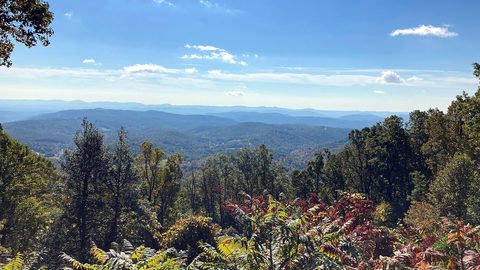 Blue Ridge and Pisgah
The Asheville and Pisgah side of the Southern Appalachians along the Blue Ridge Parkway, with waterfall loops, craft breweries, and Mount Mitchell.
-
 Great Smoky Mountains
A Great Smoky Mountains guide focused on quiet gateways like Bryson City and Townsend, dawn wildlife viewing at Cades Cove, and avoiding Gatlinburg crowds.
-
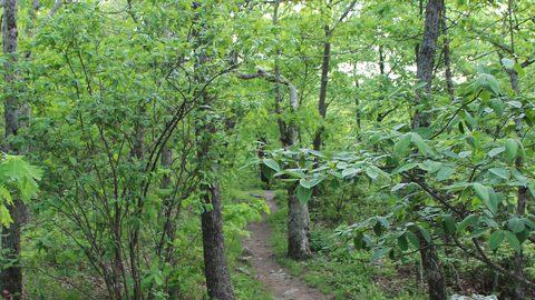 North Georgia
's quiet end of the Southern Appalachians, from Springer Mountain's AT start to Dahlonega's wine trail and Tallulah Gorge's permitted floor.