Beginning the Appalachian Trail at the Amicalola Falls Approach Trail Staircase
The Appalachian Trail Approach Trail begins with a 604-step staircase up Amicalola Falls—the first brutal test for thru-hikers before they even reach Springer Mountain.
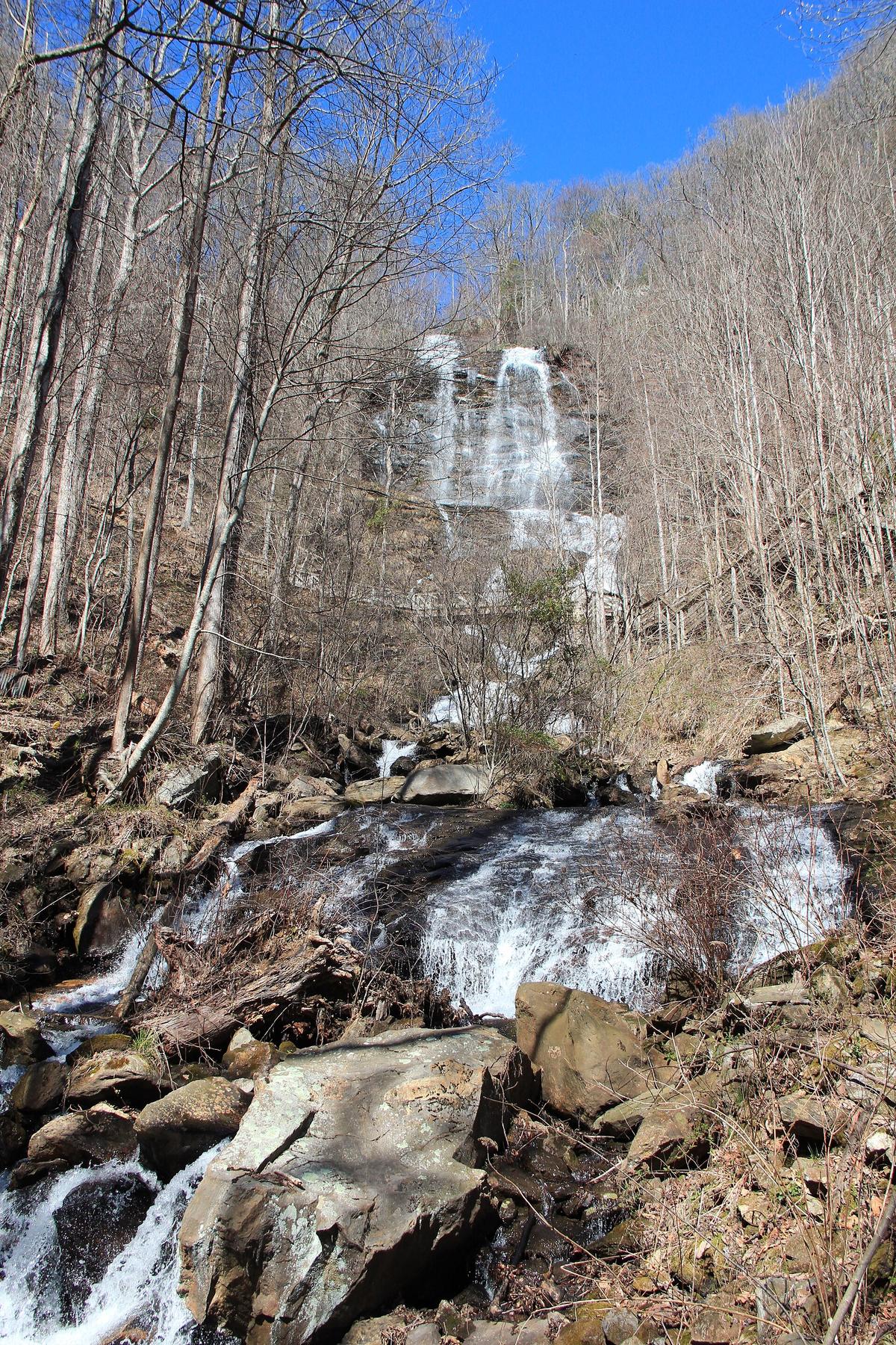

Beginning the Appalachian Trail at the Amicalola Falls Approach Trail Staircase
The Approach Trail from Amicalola Falls State Park is where most thru-hikers actually start, and it opens with 604 steel stairs bolted directly to the side of the tallest waterfall in Georgia. That staircase is not scenic. It is a test.
Walk through the visitor center first. Fill out an ATC voluntary registration form, on paper or through the ATCamp system. Staff will hand you an ATC hangtag with a unique registration number. That tag means you are committed. Then you walk outside and face the climb. The steps rise roughly 175 vertical feet. You will climb them with a fully loaded pack, and at that point every pound you packed poorly, every item you do not actually need, every luxury you told yourself you earned, will announce itself in your shoulders and knees. If you cannot manage those 604 steps, the miles ahead will break you. That is the point. The Approach Trail functions as the first filter. It is honest in a way that no guidebook ever is.
You can skip the ascent entirely. USFS Road 42 climbs to the Springer Mountain lot, and from there a 0.9 mile spur trail leads to the summit. Some hikers take that route. They miss the psychological reckoning. The steps are not a mandatory gateway. They are a choice about how you want to begin. If you choose them, you learn before you even enter the woods whether you have the willingness to endure steep terrain under weight, and whether your gear choices are sustainable. The Southern Appalachians will teach you that lesson either way, but it will happen here on the first half mile or later on a ridge in the rain, and later is worse.
- Staircase Step Count: 604
- Staircase Vertical Rise: Approximately 175 ft
- Approach Trail Start Point: Amicalola Falls State Park visitor center
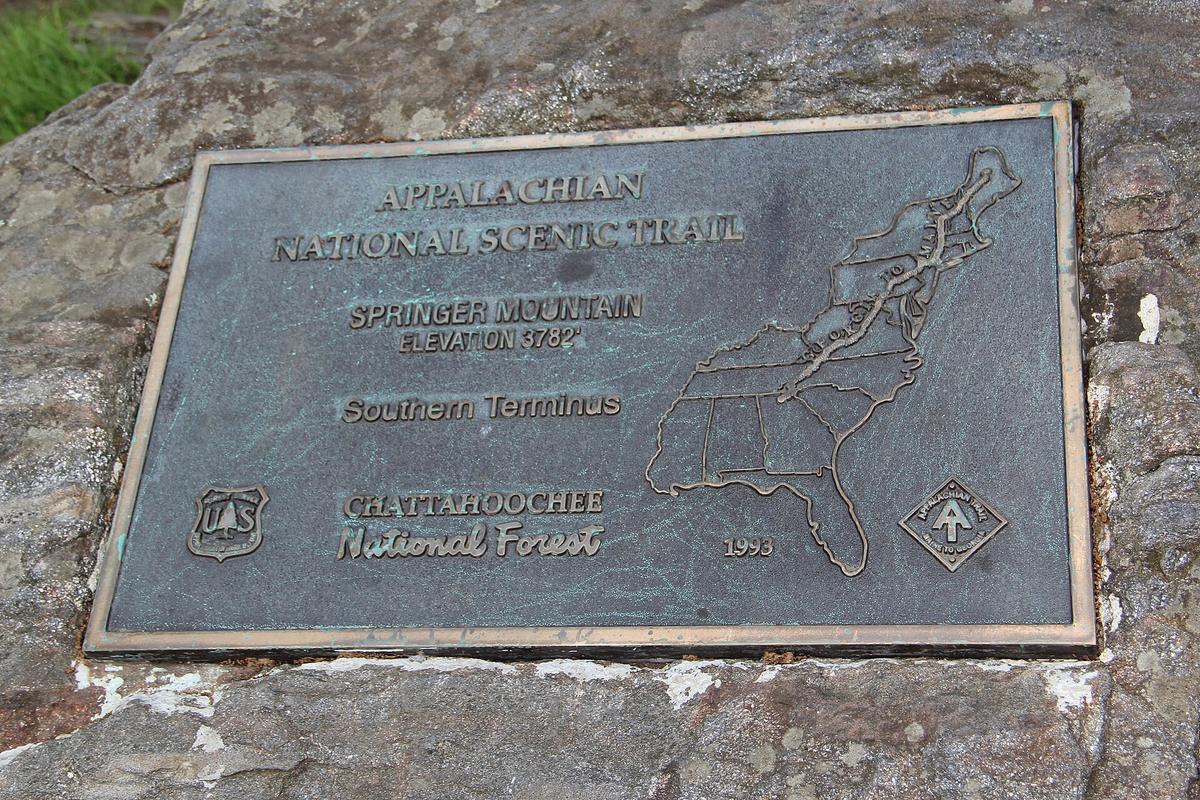
- Approach Trail End Point: Springer Mountain summit
- Approach Trail Distance: 8.8 miles (blue-blazed section to Springer Mountain summit)
- Total Elevation Gain to Springer Mountain: Approximately 3,100 ft
- AT Southern Terminus: Springer Mountain summit
- Alternative Vehicle Access to Springer Mountain: USFS Road 42 (also signed as County Road 580)
- Alternative Parking Distance to AT Terminus: 0.9 miles from Springer Mountain summit via spur trail
- Thru-Hiker Registration Location: Amicalola Falls State Park visitor center
- Registration Method: ATC voluntary form (paper or ATCamp system)
- Tag Format: ATC hangtag with unique registration number
- Peak Thru-Hiker Departure Month: March (late February through early April)
- Parking Fee: $5 per vehicle per day; Georgia State Parks Annual Pass accepted
- Payment Method: Self-pay envelope at visitor center or entrance kiosk
What the Stairs Demand of You
Gear Reality Check On The Grating
The steps are a steel grating structure, not stone carved into the hill. You see the water through the gaps. Spray from the 729 foot cascade hits your face if the wind is blowing right. The noise is constant. By step two hundred your legs remind you that you slept in a bed last night and that your pack is heavier than it should be. By step four hundred you stop caring about the view. That is the moment the test actually begins. The climb separates hikers who have trained from hikers who have only planned. If you live at sea level, budget for a day of adjustment in Dahlonega before you attempt it. Book a room, drop your pack, hike a local trail under 1,000 feet of elevation gain first. Your body needs the wake up call before the wake up call arrives on metal treads at 7:00 AM.
Pack Light For The First Eight Miles
Do not carry a full water supply for the ascent. There is a water source at the top of the falls and again at the visitor center. Fill your bottles after the climb, not before. You save about three pounds of unnecessary weight for the one part of the trail where every pound matters most. The same logic applies to food. Do not pack seven days of freeze dried meals into your bag just to walk half a mile. Your first resupply is in three days if you are heading north, and the visitor center sells snacks. Pack light for the first eight miles and eat a real breakfast in Dahlonega before you drive to the park.
The Approach Trail is not part of the Appalachian Trail proper. It is blue blazed, not white. Treating it as a warm up is a mistake. The total elevation gain from the visitor center to Springer Mountain is roughly 3,100 feet, and the terrain after the steps does not flatten out. You climb consistently for the entire 8.8 miles. The staircase is the most dramatic section but not the hardest. The hardest part is mile five, when the initial adrenaline is gone, the pack has not gotten lighter, and you still have three miles of climbing left before you reach the official AT southern terminus.
Why March Matters and How to Use it
Beat The Surge
The peak thru-hiker departure surge runs from late February through early April, with March being the single busiest month. Arrive on a Saturday in mid March and expect a queue at the visitor center registration desk and competition for the limited spaces to leave your car. Arrive on a weekday by 08:00 instead. The $5 daily fee goes into a self pay envelope at the entrance kiosk. Have cash. The envelope system does not accept credit cards at the gate. Buy a Georgia State Parks Annual Pass if you plan to return, but for a single use the $5 daily rate is the better option.
The crowd matters beyond inconvenience. The staircase becomes a bottleneck. Twenty hikers starting within ten minutes of each other turn a steep climb into an exercise in patience. You want to be at the front of that wave. A 07:30 start puts you on the steps before the bulk of the day's hikers arrive. You get the sound of the falls to yourself and the steel grating to yourself and the moment when you reach the top and look back at what you just climbed belongs entirely to you. That is worth the early alarm.
Dahlonega Logistics
One practical warning about the area around the park. The town of Dahlonega, where you will likely stay the night before, functions as the southern terminus of the Approach Trail culture. It has gold rush history and a wine trail with several tasting rooms within a short drive. Do not drink the night before the climb. Dehydration from wine country and a 3,100 foot ascent the next morning is a predictable failure mode. Book a room in Dahlonega, eat an early dinner at a local restaurant that serves soup beans and skillet cornbread, drink water, and go to bed before 21:00. The steps will be there at dawn.
.jpg)
The Psychological Test and the Decision to Start Here
No Bailout After The Waterfall
This is not a scenic loop you can bail on after the waterfall overlook. Once you start the Approach Trail you are committed to an 8.8 mile one way hike that ends on a summit with no road access except the gravel USFS Road 42. If you turn back at mile four, you still have four miles to return. That changes how you think about the ascent. It is not a photo opportunity. It is a contract you sign with your legs.
The hikers who skip the climb and drive to the Springer Mountain lot on USFS Road 42 miss this contract. They arrive at the southern terminus having tested nothing. That is a valid choice for section hikers, day hikers, and people with mobility limitations who cannot handle the steep terrain. But if you are planning a thru hike, reconsider the convenience. The steps are not sadism. They are preparation. Every thru-hiker who makes it to Katahdin will tell you that the trail breaks you down and rebuilds you. The Approach Trail staircase just starts the process earlier than most people expect.
Vehicle Strategy
Drive a car with clearance to reach the USFS Springer Mountain lot. The road is unpaved and a sedan will scrape bottom in the washboard sections. If you are dropping a vehicle at the southern end and hitching north, leave it at the Amicalola Falls lot, pay the $5 fee, and arrange for a shuttle from the other end. Do not trust a GPS that routes you onto Forest Service roads. Carry a paper DeLorme Gazetteer and set your navigation to paved roads only. The winding backroads in this region turn a 40 mile drive into 90 minutes of switchbacks, and after the climb you will not want to add a wrong turn to your afternoon.
The Approach Trail suits backpackers who want serious elevation and are willing to earn their views. It does not suit anyone seeking luxury, fine dining, or a scenic stroll. If you cannot handle 604 steps with a pack, if uneven terrain threatens your balance, if your idea of a peak experience involves a hot tub and a dinner reservation by 19:00, skip this trail. Drive to the Springer Mountain lot, walk the 0.9 mile spur trail, touch the terminus plaque, and call it done. The staircase will still be there for the people who need it.
Common Questions
How many stairs are on the Amicalola Falls Approach Trail?
There are exactly 604 steel stairs bolted to the side of Amicalola Falls. The staircase climbs approximately 175 vertical feet before the trail continues toward Springer Mountain.
Is the Amicalola Falls Approach Trail part of the Appalachian Trail?
No. The Approach Trail is an 8.8 mile blue blazed connector trail from the state park visitor center to the summit of Springer Mountain. The Appalachian Trail southern terminus is on Springer Mountain, and the Approach Trail ends there.
Can I drive to the start of the Appalachian Trail instead of taking the stairs?
Yes. USFS Road 42 provides vehicle access to the USFS Springer Mountain parking lot. From that lot, a 0.9 mile spur trail leads to the Springer Mountain summit. You skip the stairs and the 8.8 mile Approach Trail entirely.
Where do thru hikers register for the Appalachian Trail?
Thru hikers register at the Amicalola Falls State Park visitor center. The registration is voluntary and uses an ATC form, available on paper or through the ATCamp online system. You receive a hangtag with a unique registration number.
What is the parking fee at Amicalola Falls State Park?
The fee is $5 per vehicle per day, paid via a self pay envelope at the visitor center or entrance kiosk. The Georgia State Parks Annual Pass is also accepted. Have cash for the envelope system.
When is the busiest time for thru hiker departures?
March is the peak departure month, with the surge running from late February through early April. Weekends in that window mean queues at the registration desk and competition for parking.
How much elevation gain is on the entire Approach Trail?
The Approach Trail from the visitor center to Springer Mountain gains approximately 3,100 feet of elevation. The 604 step staircase accounts for about 175 feet of that total. The remaining elevation is distributed across the 8.8 mile hike.
Read next
-
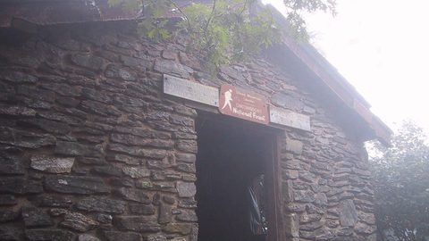
 Blood Mountain
 requires a hard-sided bear canister for all overnight campers—chronic bear activity at the historic stone shelter made the rule permanent in the Chattahoochee National Forest.
Blood Mountain
Blood Mountain requires a hard-sided bear canister for all overnight campers—chronic bear activity at the historic stone shelter made the rule permanent in the Chattahoochee National Forest.
-
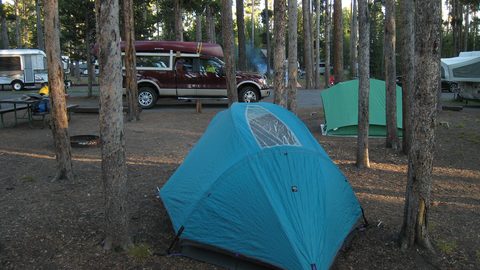 Where to Stay in the Southern Appalachians, From Backcountry Shelters to Roadside Motels
A guide to Southern Appalachian lodging: vintage Parkway motor courts, trail-town motels, cabin clusters, and backcountry shelters, with price bands and booking lead times.
Where to Stay in the Southern Appalachians, From Backcountry Shelters to Roadside Motels
A guide to Southern Appalachian lodging: vintage Parkway motor courts, trail-town motels, cabin clusters, and backcountry shelters, with price bands and booking lead times.
-
 Southern Appalachians Trail Towns Where to Base Yourself and When to Camp Instead
Match your Southern Appalachians trip to the right trail town—compare Bryson City, Brevard, Hot Springs, Dahlonega, and more by activity, lodging type, and peak-season availability.
Southern Appalachians Trail Towns Where to Base Yourself and When to Camp Instead
Match your Southern Appalachians trip to the right trail town—compare Bryson City, Brevard, Hot Springs, Dahlonega, and more by activity, lodging type, and peak-season availability.
-
 Flying Into the Southern Appalachians, Airport by Airport
Compare AVL, TYS, and CLT airports for the Southern Appalachians: drive times, rental-car costs, and why a personal vehicle is non-negotiable.
Flying Into the Southern Appalachians, Airport by Airport
Compare AVL, TYS, and CLT airports for the Southern Appalachians: drive times, rental-car costs, and why a personal vehicle is non-negotiable.
-
 Best Time to Visit the Southern Appalachians for Trails and Quiet
Season-by-season timing for the Southern Appalachians, including mud-season trail closures, October leaf-peeper gridlock, and June rhododendron blooms.
Best Time to Visit the Southern Appalachians for Trails and Quiet
Season-by-season timing for the Southern Appalachians, including mud-season trail closures, October leaf-peeper gridlock, and June rhododendron blooms.
-
 Getting Around the Southern Appalachians Without a Transit System
How to get around the Southern Appalachians when there is no transit, cell service drops, and GPS routes you onto impassable roads.
Getting Around the Southern Appalachians Without a Transit System
How to get around the Southern Appalachians when there is no transit, cell service drops, and GPS routes you onto impassable roads.
-
 Your First Week in the Southern Appalachians Built Around Weather Not a List
-
 Blue Ridge and Pisgah
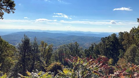
The Asheville and Pisgah side of the Southern Appalachians along the Blue Ridge Parkway, with waterfall loops, craft breweries, and Mount Mitchell.
Blue Ridge and Pisgah
The Asheville and Pisgah side of the Southern Appalachians along the Blue Ridge Parkway, with waterfall loops, craft breweries, and Mount Mitchell.
-
 Great Smoky Mountains
A Great Smoky Mountains guide focused on quiet gateways like Bryson City and Townsend, dawn wildlife viewing at Cades Cove, and avoiding Gatlinburg crowds.
Great Smoky Mountains
A Great Smoky Mountains guide focused on quiet gateways like Bryson City and Townsend, dawn wildlife viewing at Cades Cove, and avoiding Gatlinburg crowds.