Single-Day Outings Across the Southern Appalachians, Rain or Shine
Day-trip circuits from every Southern Appalachian base town, each with a wet-weather backup plan for when the mountains deliver sideways rain.
Southern Appalachia day trips turn on a simple truth: the coffee is lukewarm and the weather radar shows a solid wall of green marching up from Georgia. You are standing in a motel room in a small town with a map you cannot fold back up and a day you refuse to waste. The region is organized by base town, not by attraction, because the question is not "what is there to see" but "what can I actually do from where I am sleeping that fits into daylight hours and does not leave me driving switchbacks after dark." Each district below gets one or two realistic day-trip circuits with drive times that reflect the 25 mph corners and the fog banks. And each circuit includes a wet-weather alternative. Because the ridge you planned to hike will be inside a cloud, and you need to know that the Wheels Through Time museum is a short drive away, costs 15 dollars, and holds 350 motorcycles you can touch. Here is how to salvage the day or make it perfect.
From Asheville: the Parkway Ride and Its Rainy Backup
Asheville gives you the most flexibility because the Blue Ridge Parkway runs right past the city. The best single day in clear weather is a slow loop from Milepost 355 to Milepost 382. That is the Mount Mitchell turnoff to the Folk Art Center. Drive time without stopping is 45 minutes, but you should stop.
Craggy Gardens And The Folk Art Center
Pull over at Craggy Gardens at Milepost 364.6. The Craggy Pinnacle hike is 1.4 miles round trip and takes 45 minutes. The rhododendron tunnels bloom in June and the view opens to a sea of ridges even when the parking lot is crowded. Continue south to the Folk Art Center at Milepost 382. It is free, the craft is serious, and the restrooms are clean.
When The Parkway Disappears
If the Parkway is socked in, and it will be on most days above 5,000 feet, skip the drive and aim for the Biltmore Estate. Entry runs 70 to 110 dollars depending on season. Book ahead. The house tour takes 90 minutes to two hours. The gardens are 75 acres. It is the opposite of wilderness but it handles rain better than any overlook.
.jpg)
From Brevard: the Waterfall Loop and the Rain Pivot
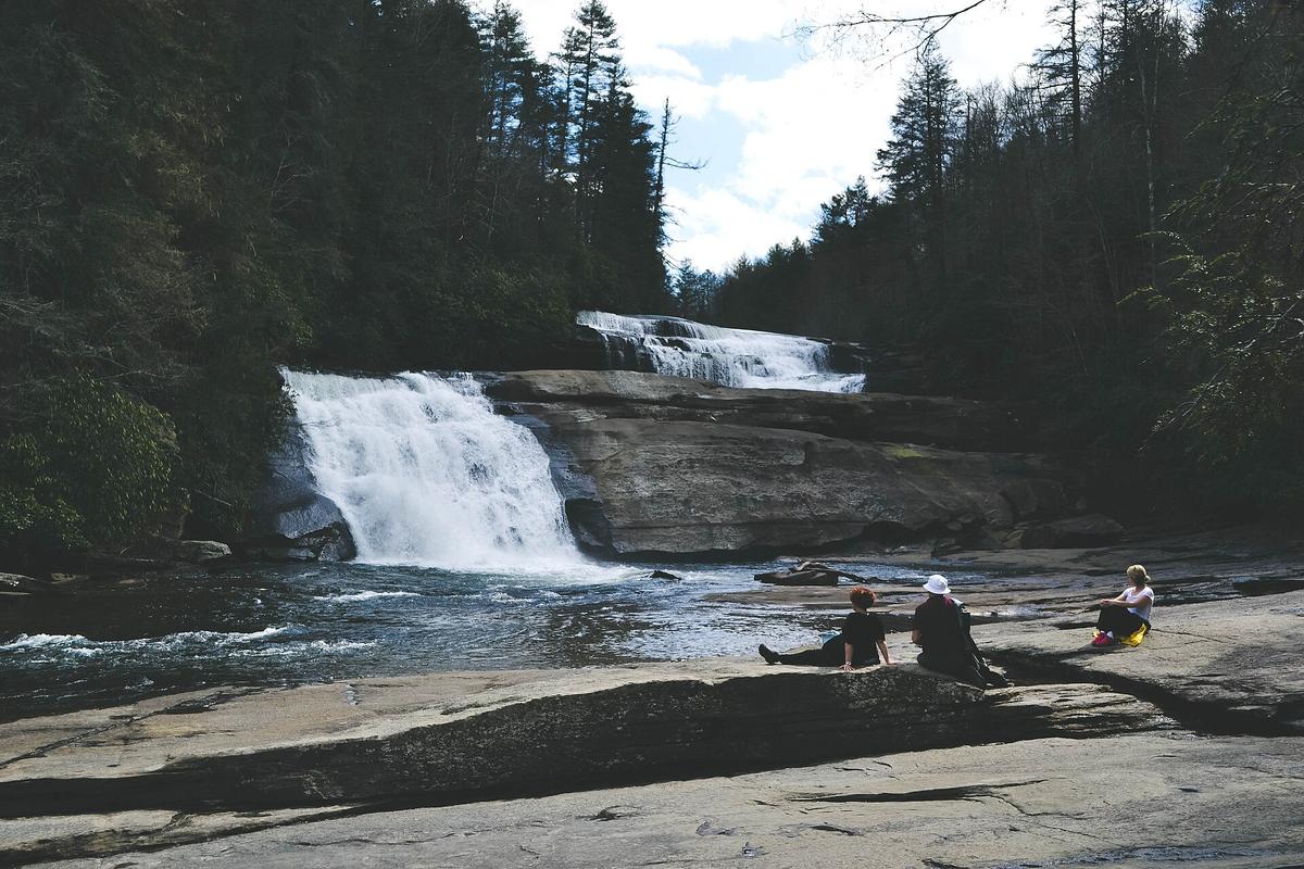
Brevard is waterfall central, and the standard loop is tight enough for a half day. Start at Looking Glass Falls on US-276. It is 60 feet tall and requires no hike. You park, you walk 50 feet, you see it. Then drive 0.3 miles to Moore Cove Falls. That one requires a 1.4 mile round trip hike to see a 50 foot veil. Finish at Sliding Rock. It costs 4 dollars per person. It operates Memorial Day through Labor Day. The water is cold and the line gets long by 11:00 AM. The full loop is 5.5 miles of driving, 25 minutes one way from Brevard.
Rain Pivot: Motorcycles In Maggie Valley
Rain alternative: Wheels Through Time in Maggie Valley, half an hour west of Brevard. 15 dollars, 350 motorcycles, and the collection spans from the 1900s to the 1970s. The owner built the building around the bikes. It is dry, it is loud, and it saves the day.
From Boone or Blowing Rock: Roan Mountain or Linville Gorge
From Boone, you have two choices and they pull in opposite directions. Roan Mountain Highlands is one hour by car to the Carvers Gap trailhead. The round trip hike to Grassy Ridge Bald is 5 miles set between 5,500 and 6,200 feet. In June, the rhododendron bloom is worth the two hour drive from Asheville, and Boone is closer. This is a clear weather hike. The balds give you 360 degree exposure. In a cloud, there is no view and the wind cuts hard.
Rain Pivot: Underground And Overlook
Rain pivot: drive south to Linville Caverns. It is half an hour from Boone on US-221. The tour takes 30 minutes, costs 12 dollars, and the temperature stays 52 degrees year round. After the cave, stop at Linville Falls at Milepost 316.4 on the Parkway. The upper overlook is a 0.5 mile round trip walk and works even in light drizzle.
| Base Town | Clear Route | Drive Time One Way | Rain Route | Rain Cost Per Adult |
|---|---|---|---|---|
| Asheville | Blue Ridge Parkway MP 355 to 382 | 45 min | Biltmore Estate | $70 to $110 |
| Brevard | Waterfall Loop (US-276) | 25 min | Wheels Through Time | $15 |
| Boone | Roan Mountain Highlands | 1 hr | Linville Caverns | $12 |
| Bryson City | Deep Creek Waterfall Loop | 15 min | Museum of the Cherokee People | $12 |
| Townsend | Cades Cove Loop Road | 20 min | Great Smoky Mountains Heritage Center | $10 |

From Bryson City and Townsend: Two Entrances to the Smokies, One Rule
Bryson City is the quiet south entrance to Great Smoky Mountains National Park. The Deep Creek trailhead is 15 minutes from downtown. The waterfall loop is 2.4 miles and passes three falls: Juney Whank, Tom Branch, and Indian Creek Falls. Tubing season runs Memorial Day through Labor Day. After the hike, drive the 11 mile Cades Cove loop? No. That is 45 minutes from Gatlinburg, but only 20 minutes from Townsend. If you are in Bryson City, Cades Cove is a 90 minute drive that eats your day. Stay at Deep Creek.
Bryson City Rain Plan
Rain alternative from Bryson City: the Museum of the Cherokee People in Cherokee, 10 minutes north. 12 dollars, serious exhibits, and it covers Cherokee history from the Mississippian period to the Trail of Tears. It is the best indoor cultural site in the region.
Townsend: The Peaceful Side
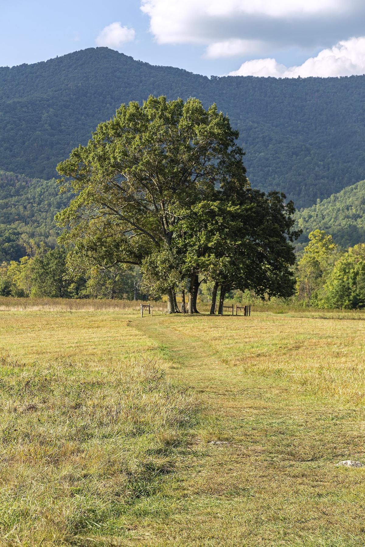
Townsend is the Peaceful Side. Cades Cove is your clear day plan. Arrive by 8:00 AM or the wildlife gridlock will cost you an hour. Wednesdays from May through September, the loop is bicycle only from sunrise to 10:00 AM. Drive time from Townsend is 20 minutes. The loop is 11 miles one way. With stops plan two to four hours. No vehicles over 25 feet. That rule is enforced. Rain alternative: the Great Smoky Mountains Heritage Center, also in Townsend. 10 dollars. Covers human history in the region from the Paleoindian period forward. Small museum, big quiet.
From Dahlonega and Little Switzerland: Wine and Gorge, with Fog Plans
Dahlonega is the southern terminus of the Appalachian Trail approach and the center of Georgia wine country. The Dahlonega Wine Trail includes five to eight tasting rooms within 20 minutes of town. This is a designated driver trip. The roads are curvy, the pours are generous, and the scenery is vineyard-on-hillside. Clear weather only. Rain does not ruin wine, but it ruins the view.
If the weather turns, skip the grapes and drive to Dahlonega itself. The Gold Museum is downtown. The historic square has a hardware store that still sells mule shoes. The cell service is fine here, but the vibe is Saturday morning, not Saturday night.
Little Switzerland: Gorge Or Caverns
Little Switzerland is a ridgeline hamlet with old school motor lodges. Your clear day trip is Linville Gorge. The Table Rock trailhead is half an hour away. The round trip hike to the summit is 2.2 miles. The gorge is called the Grand Canyon of the East for a reason. In a cloud? The clouds are the attraction. But if the mist turns to sideways rain, drive 15 minutes to Linville Caverns. Same 12 dollars, same 52 degrees, same 30 minute tour. Then drive the Parkway south to the Museum of North Carolina Minerals at Milepost 331. Free and fast.
Common Questions
How much time should I budget for a 60 mile drive in the Southern Appalachians?
Budget two to two and a half hours. The straight highway assumption fails on two lane roads with 25 mph switchbacks, fog, and pull offs. Never drive those roads after dark. Fill your gas tank at half full because stretches of 40 miles without fuel are common.
What do I do if the Blue Ridge Parkway closes while I am on it?
Have a non Parkway alternate route loaded on your phone before you lose signal. The Parkway closes for ice and fog without notice. Use the NPS real time road closure map each morning before you leave your motel. Cell service dies in the backcountry, so download offline Google Maps and AllTrails layers before you go.
Which base town is best for avoiding crowds in October?
Townsend and Bryson City. October weekends on the north side of the Smokies near Gatlinburg are gridlock. Bryson City and Townsend offer Smokies access without the neon chaos. Book lodging six months ahead for October. The second and third weeks are peak color and peak crowding everywhere.
Can I visit the Biltmore Estate on the same day I drive the Parkway?
Yes, but only if you start by 8:00 AM. Do the Parkway section from Milepost 355 to 382 in the morning when fog often clears by 10:00. Then drive to Biltmore for an afternoon house tour. Budget 90 minutes for the house and 75 dollars per ticket. Skip the third party bundles. Book direct.
Is Sliding Rock open in September?
No. Sliding Rock operates from Memorial Day weekend through Labor Day weekend. Outside that window the water is too cold and the lifeguards are gone. The parking lot is still accessible for a photo of the rock slide itself, but you cannot slide.
Read next
-
 Where to Stay in the Southern Appalachians, From Backcountry Shelters to Roadside Motels
A guide to Southern Appalachian lodging: vintage Parkway motor courts, trail-town motels, cabin clusters, and backcountry shelters, with price bands and booking lead times.
Where to Stay in the Southern Appalachians, From Backcountry Shelters to Roadside Motels
A guide to Southern Appalachian lodging: vintage Parkway motor courts, trail-town motels, cabin clusters, and backcountry shelters, with price bands and booking lead times.
-
 Southern Appalachians Trail Towns Where to Base Yourself and When to Camp Instead
Match your Southern Appalachians trip to the right trail town—compare Bryson City, Brevard, Hot Springs, Dahlonega, and more by activity, lodging type, and peak-season availability.
Southern Appalachians Trail Towns Where to Base Yourself and When to Camp Instead
Match your Southern Appalachians trip to the right trail town—compare Bryson City, Brevard, Hot Springs, Dahlonega, and more by activity, lodging type, and peak-season availability.
-
 Flying Into the Southern Appalachians, Airport by Airport
Compare AVL, TYS, and CLT airports for the Southern Appalachians: drive times, rental-car costs, and why a personal vehicle is non-negotiable.
Flying Into the Southern Appalachians, Airport by Airport
Compare AVL, TYS, and CLT airports for the Southern Appalachians: drive times, rental-car costs, and why a personal vehicle is non-negotiable.
-
 Best Time to Visit the Southern Appalachians for Trails and Quiet
Season-by-season timing for the Southern Appalachians, including mud-season trail closures, October leaf-peeper gridlock, and June rhododendron blooms.
Best Time to Visit the Southern Appalachians for Trails and Quiet
Season-by-season timing for the Southern Appalachians, including mud-season trail closures, October leaf-peeper gridlock, and June rhododendron blooms.
-
 Getting Around the Southern Appalachians Without a Transit System
How to get around the Southern Appalachians when there is no transit, cell service drops, and GPS routes you onto impassable roads.
Getting Around the Southern Appalachians Without a Transit System
How to get around the Southern Appalachians when there is no transit, cell service drops, and GPS routes you onto impassable roads.
-
 Your First Week in the Southern Appalachians Built Around Weather Not a List
-
 Blue Ridge and Pisgah
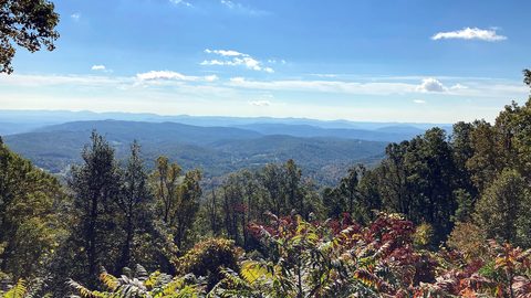
The Asheville and Pisgah side of the Southern Appalachians along the Blue Ridge Parkway, with waterfall loops, craft breweries, and Mount Mitchell.
Blue Ridge and Pisgah
The Asheville and Pisgah side of the Southern Appalachians along the Blue Ridge Parkway, with waterfall loops, craft breweries, and Mount Mitchell.
-
 Great Smoky Mountains
A Great Smoky Mountains guide focused on quiet gateways like Bryson City and Townsend, dawn wildlife viewing at Cades Cove, and avoiding Gatlinburg crowds.
Great Smoky Mountains
A Great Smoky Mountains guide focused on quiet gateways like Bryson City and Townsend, dawn wildlife viewing at Cades Cove, and avoiding Gatlinburg crowds.
-
 North Georgia
's quiet end of the Southern Appalachians, from Springer Mountain's AT start to Dahlonega's wine trail and Tallulah Gorge's permitted floor.
North Georgia
North Georgia's quiet end of the Southern Appalachians, from Springer Mountain's AT start to Dahlonega's wine trail and Tallulah Gorge's permitted floor.