Climbing the Looking Glass Rock Trail to the Granite Summit in Pisgah National Forest
The Looking Glass Rock Trail climbs 1,700 feet in 3 miles to an exposed granite dome with no guardrails—stunning views, but wet rock and vertigo are real dangers.
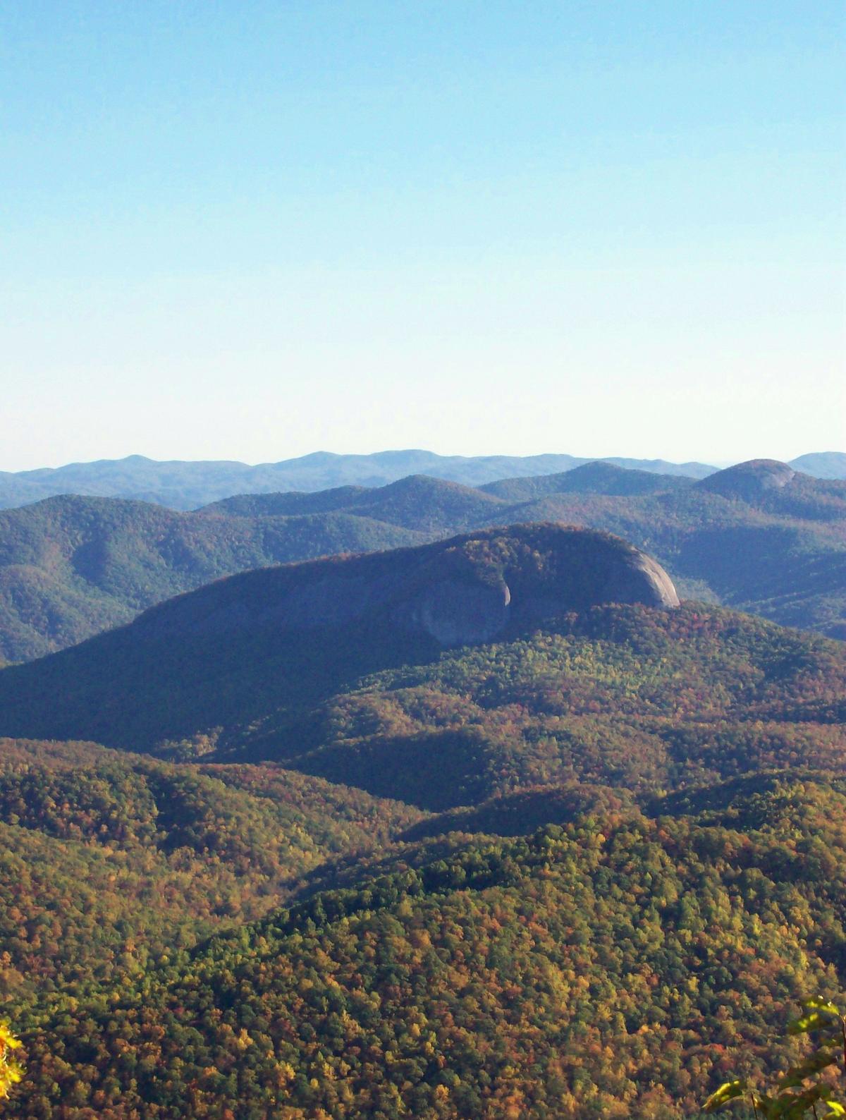

Climbing the Looking Glass Rock Trail to the Granite Summit in Pisgah National Forest
The trail breaks out of rhododendron tunnel at switchback 28, and the air changes. One moment you are under a green roof, the next you stand on bare rock with 400 feet of air below your left boot. This is the moment that separates hikers who read the warnings from hikers who ignore them.
The Looking Glass Rock Trail in Pisgah National Forest is 6.4 miles round trip with 1,700 feet of elevation gain. It climbs 34 switchbacks through dense forest, then deposits you on a 1-acre stone slab with no guardrails, no fences, and a white painted helipad that tells you exactly how many rescues have ended here. This is not a casual stroll. It is a strenuous, exposed hike that demands respect for the rock and the weather.
- Total Distance: 6.4 miles (10.3 km) out-and-back
- Elevation Gain: 1,700 ft (518 m)
- Summit Elevation: 3,969 ft (1,210 m)
- Switchbacks: 34
- Average Hike Time: 3 to 5 hours round trip
- Trailhead: Looking Glass Rock Trailhead, US Highway 276
- Parking Fee: $3 per vehicle day pass
- Parking Fill Time: Before 9:00 AM on weekends, before 10:00 AM on weekdays
What the Climb Actually Feels Like
Getting a Spot and Starting Out
Start early. The lot holds roughly 25 vehicles, and on weekends it fills before 9:00 AM. Weekdays give you until 10:00 AM. After that, you pull onto the roadside pull-offs of US 276 or you turn around. No overflow lot exists. No shuttle runs here.
The trail (Forest Service Trail #110) begins at 2,260 feet and wastes no time. It rises through a hardwood forest on a packed dirt path with exposed roots and embedded rocks. The grade is unrelenting. You gain most of the 1,700 feet in the first 2.5 miles, and the switchbacks keep coming. Count them if you want a distraction. You will pass 34 before the summit. The path tunnels through rhododendron thickets that close in overhead, blocking the sun and keeping the ground damp even on dry days. In June, the blooms are purple and white. In October, the leaves are yellow.
When to Stay Home
In March, the trail is mud. Skip it entirely. Mid-March through early April is mud season, and many trails close to prevent erosion.
The Final Push
At roughly mile 2.8, the forest breaks. You step onto the bare stone dome. There is no transition. No warning sign. One second you are in the trees, the next you are on open rock with the entire Pisgah National Forest laid out below. The summit sits at 3,969 feet, and the slab slopes gently at first, then steeply toward the north and east edges where the drop is 200 to 400 feet straight down. No rails. No cables. Just rock and sky.
The Granite Slab: Exposure, Friction, and the Helipad
Dry Rock vs. Wet Rock
The stone is Whiteside granite, a coarse surface that gives you high traction when dry. You can walk comfortably on a 20-degree slope if the rock is clean. But wet rock is a different surface entirely. Friction drops to near zero. A light drizzle, morning dew, or fog that rolled in while you were hiking makes the slab slick as polished glass. Do not attempt the summit in wet conditions. Turn around at the treeline. The rock holds moisture for hours after rain stops, so check the forecast for the hours before your hike, not just the current conditions.
The Helipad and the Risk
The most sobering feature on the summit is a painted white H inside a circle, a helicopter landing zone. That helipad exists because hikers and climbers get injured on this slab with regularity. Rescues require airlift. The H is not a decoration. It is a reminder that a fall off the north or east side ends in a 200 to 400 foot drop onto boulders, and that cell service to call for help is zero at this trailhead and on the summit.
If you have a fear of heights, or you freeze on exposed ledges, skip this hike. The Linville Gorge overlook trail or the Craggy Gardens walk give you views without the vertigo. The Looking Glass summit is not the place to test your tolerance. If you go, stay back from the edge. Do not walk beyond the H. Do not chase a photo. The view from 20 feet inside the safe zone is the same view from the edge, and it comes without the risk of a helicopter ride.

What Else Matters Before You Go
No Signal, No Help
Cell service is dead. Verizon and AT&T have the least bad coverage in the Southern Appalachians, but at this trailhead and on the summit, it drops to zero. T-Mobile is nearly useless outside town limits. Download offline Google Maps and AllTrails layers before you leave Wi-Fi. Carry a paper map or DeLorme Gazetteer. GPS navigation apps that need a signal will fail you here.
Clock and Calendar
Timing is everything. Budget 3 to 5 hours round trip. If you start later than 10:00 AM on a weekend, you compete for a space and you hike in the afternoon heat. If you start after 2:00 PM, you risk finishing in darkness on a trail with no artificial light and a summit that loses its grip when the sun drops. Do not start after 2:00 PM.
Climbers and Waterfalls
Climbers use a separate trail. The Looking Glass Rock Climbers Trail departs from the same lot and accesses the 100-plus climbing routes on the pluton's face. Multi-pitch traditional and sport climbs range from 5.4 to 5.14a. Hikers and climbers share the summit slab and the base approach. Give climbers space when they are roped up. Do not walk under a climbing party.
Nearby waterfalls reward a shorter day. Looking Glass Falls is 0.4 miles south on US 276, a 60-foot cascade accessible from a roadside stairway. Moore Cove Falls is 1.1 miles south, a 1.4-mile out-and-back to a 50-foot drop. Sliding Rock, the natural water slide, is 6.5 miles south on the same road and costs $4 per person. These are good options if the slab is wet or if the lot is full.
Pay the fee. The $3 day pass covers the trailhead. America the Beautiful Interagency Passes are accepted. The fee station is at the lot; bring cash or card. Rangers check.
Common Questions
How dangerous is the granite slab at the top of Looking Glass Rock?
The slab has no guardrails or fences. The north and east edges have sheer 200 to 400 foot drops. Friction is high when dry but near zero when wet or icy. Stay well back from the edge, especially if the rock is damp.
Can I hike Looking Glass Rock in the rain?
No. Do not attempt the summit in wet conditions. The rock becomes extremely slippery. Turn around at the treeline if rain starts or if the surface is wet from earlier precipitation.
Is there cell service on the trail or at the top?
No. Cell service is zero at the trailhead and on the summit. Download offline maps and trail data before you leave Wi-Fi. Carry a paper map as backup.
How early should I arrive for parking?
Arrive before 9:00 AM on weekends and before 10:00 AM on weekdays. The lot holds about 25 vehicles. Overflow is limited to roadside pull-offs on US 276.
What is the white H painted on the summit?
It is a helicopter landing zone for emergency medical evacuations. Rescues happen here. The helipad is a reminder that falls on this slab can be fatal and that help takes time to arrive.
Is Looking Glass Rock suitable for beginners or children?
Not recommended. The 6.4-mile round trip gains 1,700 feet on steep, uneven terrain with exposed drop-offs at the summit. People with mobility limitations or fear of heights should choose a different hike.
Can I combine this hike with nearby waterfalls?
Yes. Looking Glass Falls is 0.4 miles south of the trailhead, Moore Cove Falls is 1.1 miles south, and Sliding Rock is 6.5 miles south on US 276. Visit these on a separate day or after your hike if you have daylight left.
Read next
-
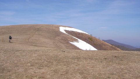
 Max Patch
 is now day-use only with no camping and no fires—the Forest Service closed it to overnight use after the iconic bald was trashed by overuse.
Max Patch
Max Patch is now day-use only with no camping and no fires—the Forest Service closed it to overnight use after the iconic bald was trashed by overuse.
-
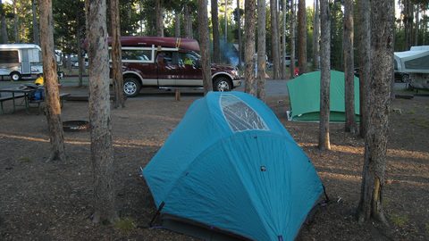 Where to Stay in the Southern Appalachians, From Backcountry Shelters to Roadside Motels
A guide to Southern Appalachian lodging: vintage Parkway motor courts, trail-town motels, cabin clusters, and backcountry shelters, with price bands and booking lead times.
Where to Stay in the Southern Appalachians, From Backcountry Shelters to Roadside Motels
A guide to Southern Appalachian lodging: vintage Parkway motor courts, trail-town motels, cabin clusters, and backcountry shelters, with price bands and booking lead times.
-
 Southern Appalachians Trail Towns Where to Base Yourself and When to Camp Instead
Match your Southern Appalachians trip to the right trail town—compare Bryson City, Brevard, Hot Springs, Dahlonega, and more by activity, lodging type, and peak-season availability.
Southern Appalachians Trail Towns Where to Base Yourself and When to Camp Instead
Match your Southern Appalachians trip to the right trail town—compare Bryson City, Brevard, Hot Springs, Dahlonega, and more by activity, lodging type, and peak-season availability.
-
 Flying Into the Southern Appalachians, Airport by Airport
Compare AVL, TYS, and CLT airports for the Southern Appalachians: drive times, rental-car costs, and why a personal vehicle is non-negotiable.
Flying Into the Southern Appalachians, Airport by Airport
Compare AVL, TYS, and CLT airports for the Southern Appalachians: drive times, rental-car costs, and why a personal vehicle is non-negotiable.
-
 Best Time to Visit the Southern Appalachians for Trails and Quiet
Season-by-season timing for the Southern Appalachians, including mud-season trail closures, October leaf-peeper gridlock, and June rhododendron blooms.
Best Time to Visit the Southern Appalachians for Trails and Quiet
Season-by-season timing for the Southern Appalachians, including mud-season trail closures, October leaf-peeper gridlock, and June rhododendron blooms.
-
 Getting Around the Southern Appalachians Without a Transit System
How to get around the Southern Appalachians when there is no transit, cell service drops, and GPS routes you onto impassable roads.
Getting Around the Southern Appalachians Without a Transit System
How to get around the Southern Appalachians when there is no transit, cell service drops, and GPS routes you onto impassable roads.
-
 Your First Week in the Southern Appalachians Built Around Weather Not a List
-
 Great Smoky Mountains
A Great Smoky Mountains guide focused on quiet gateways like Bryson City and Townsend, dawn wildlife viewing at Cades Cove, and avoiding Gatlinburg crowds.
Great Smoky Mountains
A Great Smoky Mountains guide focused on quiet gateways like Bryson City and Townsend, dawn wildlife viewing at Cades Cove, and avoiding Gatlinburg crowds.
-
 North Georgia
's quiet end of the Southern Appalachians, from Springer Mountain's AT start to Dahlonega's wine trail and Tallulah Gorge's permitted floor.
North Georgia
North Georgia's quiet end of the Southern Appalachians, from Springer Mountain's AT start to Dahlonega's wine trail and Tallulah Gorge's permitted floor.