How to Section Hike the Southern AT, From Springer Mountain to the Smokies
Section-hike the southern Appalachian Trail in pieces: Springer to Neels Gap, the Smokies, and Max Patch to Hot Springs, with shuttle and permit logistics.

Section Hiking the Southern AT: Four Trips Across 245 Miles
You have a full time job, not a gap year. The southern Appalachian Trail from Springer Mountain to Hot Springs is 245 miles of relentless terrain. Hiking it straight demands 22 to 33 days on trail. Do not quit your job. Break it into four sections across separate years. Each one fits into a week of vacation plus travel days.
The logistics of rides, resupply and permits decide whether you spend your trip hiking or chasing a lift from a gas station without cell service. Every section setup here eliminates wasted vacation days so you hike instead of scrambling for a shuttle.
Section 1: Springer Mountain to Neels Gap, 31.3 Miles, 3 to 4 Days
Parking And Your First Ride
This is the start. Begin at Amicalola Falls State Park, where thru-hikers register, or at the Springer Mountain trailhead on the USFS gravel lot. Park at Neels Gap, where the Walasi-Yi hostel and outfitter sit right on the trail. Reserve a ride from Ron's Appalachian Trail service ($1.50 to $3.00 per mile, book 1 to 7 days ahead) to take you from Neels Gap up to the Amicalola approach trail or the Springer Mountain lot. Add one day for the 8.8 mile approach trail from Amicalola to Springer if you want the official start.
Terrain, Water And The Bubble
The terrain is continuous ridge walking at 2,500 to 4,461 feet with frequent pointless ups and downs. They will teach you why southern AT miles are half the speed of flat trail miles. Resupply is not needed in 31 miles, but you can buy snacks and fuel at the Neels Gap outfitter when you finish. Water runs every 3 to 7 miles. Carry two litres. No permit is required for this section. Camp at designated shelter areas or dispersed sites.
The thru-hiker bubble peaks here March 15 to April 15. Start before March 10 or after April 25 to avoid it. If you hit the bubble, target weekdays for shelter use and expect full shelters every night.
Section 2: Neels Gap to Nantahala Outdoor Center, 27 Miles, 3 to 4 Days
Setting Up The Longest Leg
This is the longest single section and the one that moves you from Georgia into North Carolina. Park at the Nantahala Outdoor Center (NOC), where long term parking is $5 to $10 per night. Get a ride back to Neels Gap from the NOC using A Walk in the Woods or the NOC's own service. Or use a two car key swap at the midpoint.
North Carolina High Ground
The terrain shifts to North Carolina's highest AT elevations, 3,000 to 6,643 feet, with steep climbs, spruce fir zones and open balds. Expect 7 to 10 miles per day. Resupply at Hiawassee (mile 69.9 via Dick's Creek Gap, 0.8 mile side road hitch or ride) and at the NOC store (mile 137.1, full resupply with hot food and a bunkhouse). Water runs every 2 to 6 miles in North Carolina. No permit for national forest sections. Bear canisters are not required except in Shining Rock Wilderness. Use a bear bag hang.
The NOC And A Smarter Direction
This section crosses the Nantahala River Gorge. The NOC is a hub with showers and a restaurant. Book your NOC bunk two weeks ahead in summer. The thru hiker bubble hits this section in April.
Southbound option: start at the NOC and hike north to Neels Gap. This puts the climbing on your terms if you prefer uphill to downhill. Most section hikers miss this option. Use it.
Section 3: the Great Smoky Mountains, Fontana Dam to Davenport Gap, 72 Miles, 6 to 8 Days
Permits Decide Everything
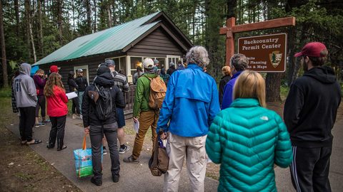
The Smokies require a backcountry permit for every overnight stay. Reserve it on recreation.gov, site specific, $4 per night. Booking opens 30 days ahead. Book exactly at 30 days. This section has mandatory shelter use if space is available; tenting is only permitted if the shelter is full. Section hikers with reservations get priority over thru hikers.
Parking, Routes And Water
Park at Fontana Dam, which has an NPS lot with long term parking. Then take a ride from the Fontana Marina or a Smokies-specific service to the dam, or to Newfound Gap if you want a shorter section. The alternates: park at Newfound Gap (mile 207) and hike the 72 miles north to Davenport Gap, or hike the crest from Fontana Dam to Newfound Gap at 47 miles. Choose the full 72 miles. The Smokies crest is the highest sustained section on the entire AT, topping out at Clingmans Dome at 6,643 feet. Water runs 3 to 8 miles; some ridge sections are dry. Carry three litres on the crest. Resupply at Fontana Dam Village store, at Gatlinburg via Newfound Gap (thumb a ride or book ahead; the road closes for ice without notice), and at Standing Bear Farm (mile 241.9, a hiker hostel with a small store).
Weather Kills Here
The thru hiker bubble peaks in the Smokies April 1 to April 30. Hike this section in May or September to avoid it entirely. If you hit fog on the crest, turn around. The trail follows a narrow exposed ridge and white out conditions have killed hikers. Check the GSMNP weather forecast at the visitor centre before you start the crest.
Section 4: Max Patch to Hot Springs, 33 Miles, 3 to 4 Days
The Reward Section
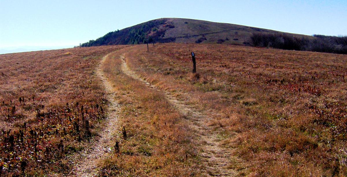
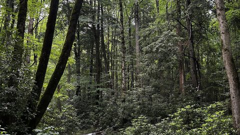
This is the reward section. Do not underestimate it. Park at Hot Springs, where the town has a $5 per night long term lot next to the trailhead. Reserve a ride to Max Patch from Mountain Harbour B&B or Uncle Johnny's. The cost is $1.50 to $3.00 per mile. Max Patch is a bald summit with 360 degree views where the AT crosses open grassland. The trail then drops into dense forest and follows ridges to the French Broad River valley.
Hot Springs And Storm Sense
You end in Hot Springs, a true trail town with hot mineral baths, hiker culture and a full grocery resupply. The terrain is ridge and gap walking at 1,800 to 6,621 feet. Permit not required. Water runs 3 to 8 miles. No resupply on trail. Carry three days of food from Hot Springs or mail a drop to Mountain Harbour. Book the hot springs bath ahead; weekend slots fill two weeks in advance. This section works as a three day weekend if you push 11 to 12 miles per day.
Do not skip Max Patch in bad weather. The bald has no shelter and lightning risk is real. If thunderstorms are forecast, start from Hot Springs and hike south toward Max Patch so you can bail downhill.
_(17538602925).jpg)
The Shuttle and Logistics Decisions That Make or Break Your Trip
Drive Times And Road Closures
Every section hike fails for the same reason: the hiker underestimated drive time and could not find a ride. The winding two lane mountain roads turn a 40 mile drive into 90 minutes of switchbacks. Budget drive time at double what Google Maps says. Rideshare apps do not work outside Asheville city limits. You must rent a car from Asheville Regional (AVL, 25 minutes to town, $50 per day), McGhee Tyson near Knoxville (TYS, 45 minutes to Townsend, $45 per day) or Charlotte Douglas (CLT, 2.5 hours to Boone, $40 per day).
The Blue Ridge Parkway is the spine of the region but it closes for ice and fog without warning. Check the NPS real time road closure map every morning. Carry a paper DeLorme Gazetteer and set your navigation to paved roads only. Unpaved Forest Service roads will destroy a sedan.
Four Ways To Solve The Car Problem
For the car problem, you have four options. Leave your car at the end point and get a ride to the start. This costs $1.50 to $3.00 per mile but means you drive home the same day you finish. Use a two car key swap with a second vehicle at the midpoint. Pay a hostel for long term parking at $5 to $10 per night. Or take Amtrak to Gainesville, Georgia and a ride from there, or Greyhound to a trail town.
Phones, Fuel And Dead Zones
Book rides 1 to 7 days ahead, longer during the March through April thru hiker bubble. Cell service is zero at most trailheads. Download offline Google Maps and AllTrails layers before you leave Wi Fi. Verizon and AT&T have the least bad coverage but even they drop to zero in deep coves. T Mobile is useless outside town limits.
Fill your gas tank at half a tank. Stretches of 40 miles without fuel exist on the Parkway and between small towns. Gas station deserts end your trip.
| Section | Mileage | Days | Permit | Resupply Point |
|---|---|---|---|---|
| Springer Mountain to Neels Gap | 31.3 | 3 to 4 | None | Neels Gap Outfitter |
| Neels Gap to Nantahala Outdoor Center | 27 | 3 to 4 | None (except Shining Rock Wilderness) | Hiawassee (via Dick's Creek Gap) and NOC Store |
| Fontana Dam to Davenport Gap (Smokies) | 72 | 6 to 8 | GSMNP backcountry permit, $4/night, site-specific on recreation.gov | Fontana Dam Store, Gatlinburg (via Newfound Gap), Standing Bear Farm |
| Max Patch to Hot Springs | 33 | 3 to 4 | None | Hot Springs Grocery, Mountain Harbour B&B Drop |
Common Questions
Can I section hike the southern AT without a car?
No. You must rent a car. Rideshare apps do not work once you leave Asheville city limits. The shuttle network exists for trailhead to trailhead transport, not for getting you from the airport to the trail. Rent from Asheville Regional, McGhee Tyson near Knoxville, or Charlotte Douglas.
How far ahead do I need to book Smokies permits?
Book exactly 30 days ahead on recreation.gov. Smokies backcountry permits are site specific and $4 per night. The popular shelters along the AT crest fill within hours of opening. Set a calendar reminder for 30 days before your first night on trail.
What is the cheapest way to handle a one way section hike?
Leave your car at the end point and get a ride to the start. Rates run $1.50 to $3.00 per mile. For a 31.3 mile section like Springer to Neels Gap, a ride from Neels Gap to Amicalola Falls costs roughly $50 to $90. Two car key swaps work if you have a second vehicle and a partner.
How many miles per day should I plan for the southern AT?
Plan 8 to 12 miles per day in Georgia and Tennessee, and 7 to 10 miles per day in North Carolina. The same hiker would do 15 to 20 miles per day on Mid Atlantic AT sections. The cumulative elevation gain in North Carolina is 20,000 feet over 95.5 miles. Do not plan higher mileage your first section.
Can I camp outside shelters in the Smokies?
Only if the shelter is full. Section hikers with reservations get priority over thru hikers. If you want to tent, you must reserve a tent site on recreation.gov at a designated backcountry campsite, not at the shelter area. The Smokies do not allow dispersed camping.
When should I avoid the southern AT to miss thru hikers?
Avoid March 15 through April 15 in Georgia, and April 1 through April 30 in the Smokies. Start your section before March 10 or after April 25. Hike southbound from a midpoint to face the bubble head on. Target weekdays for shelter use. October leaf peeping season brings different crowding on the Blue Ridge Parkway but less on trail.
What do I do if the Blue Ridge Parkway closes while I am on trail?
Use your non parkway alternate route. US 441 through the Smokies also closes for ice, fog and rock slides with no advance notice. Carry a paper DeLorme Gazetteer with marked paved secondary roads. Download offline maps before you leave Wi Fi. Never depend on a single road to reach your trailhead or pickup point.
Read next
-
 Southern Appalachians Winter Hiking What Stays Open and What Ices Over
Which Southern Appalachian trails stay open in winter, which roads ice over and close without warning, and how to hike safely when the Parkway shuts down.
Southern Appalachians Winter Hiking What Stays Open and What Ices Over
Which Southern Appalachian trails stay open in winter, which roads ice over and close without warning, and how to hike safely when the Parkway shuts down.
-
 Southern Appalachians Waterfall Hikes Worth the Drive and the Ones That Kill
The Southern Appalachian waterfall hikes that have killed people, the specific hazards on each trail, and safer nearby alternatives.
Southern Appalachians Waterfall Hikes Worth the Drive and the Ones That Kill
The Southern Appalachian waterfall hikes that have killed people, the specific hazards on each trail, and safer nearby alternatives.
-
 Smokies vs Blue Ridge Which Half of the Southern Appalachians Fits Your Week
Smokies or Blue Ridge for a one-week Southern Appalachians trip—how the two halves compare in crowds, terrain, towns, and daily logistics.
Smokies vs Blue Ridge Which Half of the Southern Appalachians Fits Your Week
Smokies or Blue Ridge for a one-week Southern Appalachians trip—how the two halves compare in crowds, terrain, towns, and daily logistics.
-
 Southern Appalachian Permits and Reservations You Need to Book Ahead
Every Southern Appalachian permit and reservation you need to book ahead: Grandfather Mountain, Biltmore, Tallulah Gorge floor access, and backcountry quotas.
Southern Appalachian Permits and Reservations You Need to Book Ahead
Every Southern Appalachian permit and reservation you need to book ahead: Grandfather Mountain, Biltmore, Tallulah Gorge floor access, and backcountry quotas.